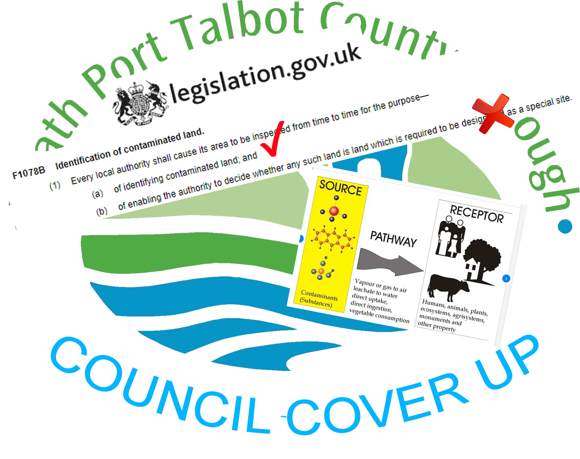
| The Neath Port Talbot Council
Planning Department were bound by law to pass on the
contamination information to the Contaminated Land Team at Neath
Port Talbot Council. This they should have already done by the
end of April 2009 because the council has to abide by
the............. Environmental Protection Act
1990 - Part IIA
Council regulations for contaminated land in 2008 were contained in
the 2005
NPTC Contaminated Land Strategy. This document states
"Part IIA of the Environment
Protection Act 1990, was introduced in Wales on July 1st
2001, until this time there had been no strategic approach to
the identification of contaminated land. Land contamination had
always been addressed during redevelopment or when the risk has
manifested itself. Since 2001, all local authorities have a duty
to inspect their areas, locate and ensure the remediation of all
statutory designated contaminated land. One of the key
objectives of the council's strategy (Key Objective 4:) is to
ensure that during the redevelopment of new sites, land
contamination issues are dealt with effectively and at an early
stage of the planning process."
The document says that the contamination should have been
dealt in the early stages of the planning process. If we refer
again to the..................
Environmental Protection Act
1990 - Part IIA
........Identification
of contaminated land.
The opening points of which
are................
(1) Every local authority shall cause its area to be inspected
from time to time for the purpose—
(a) of identifying contaminated land; and
(b) of enabling the authority to decide whether any such land is
land which is required to be designated as a special site.
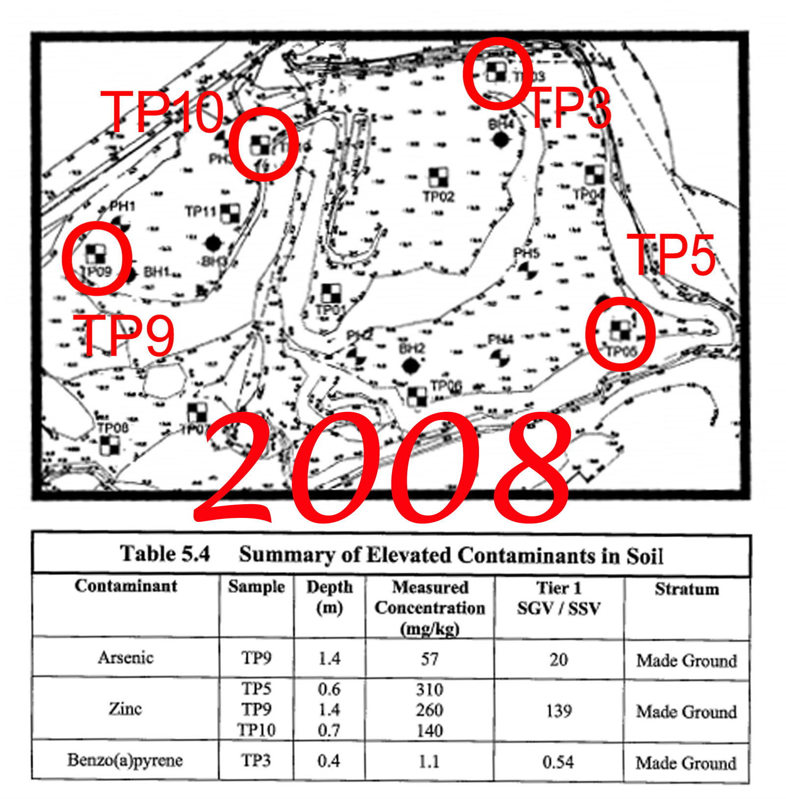
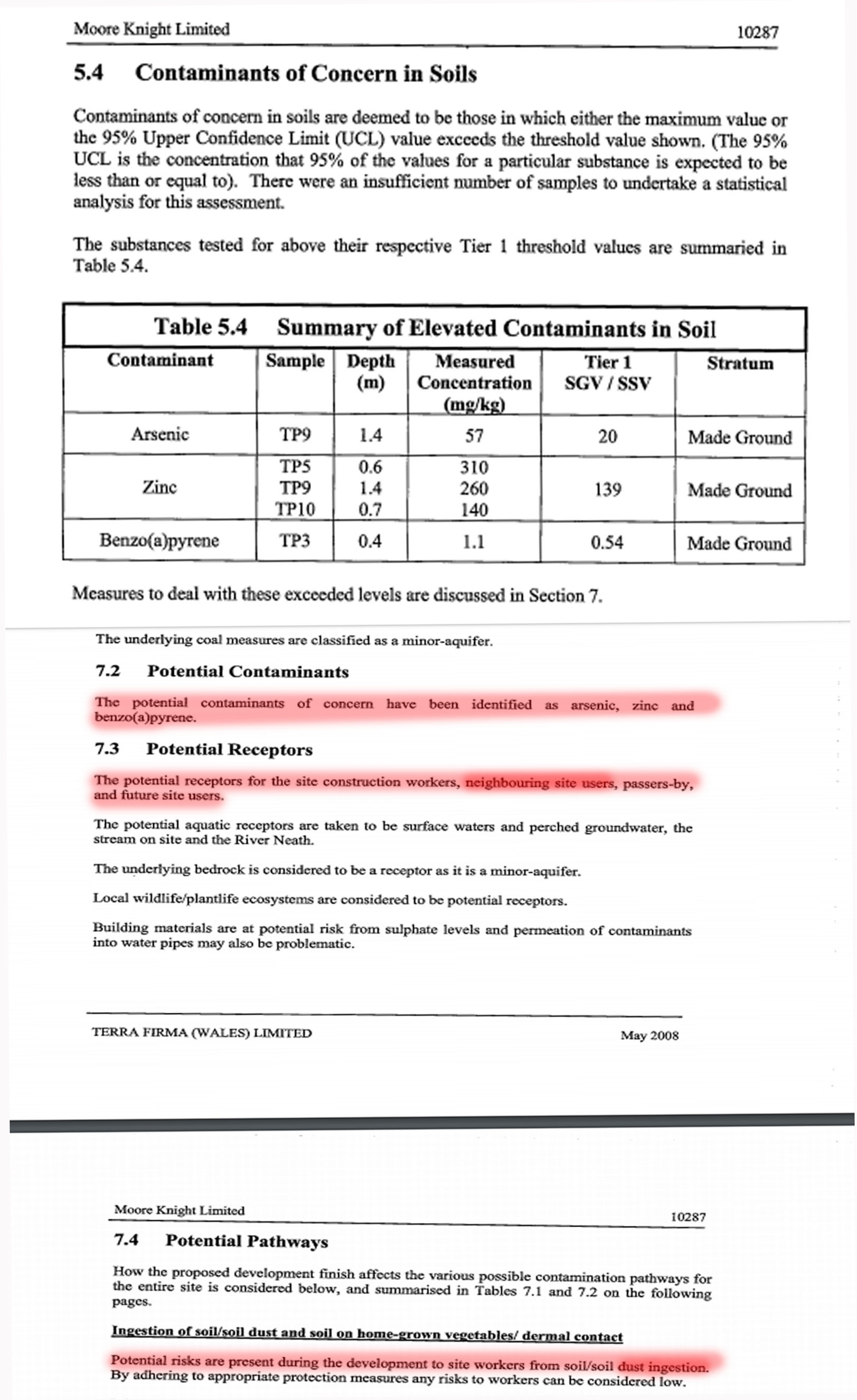
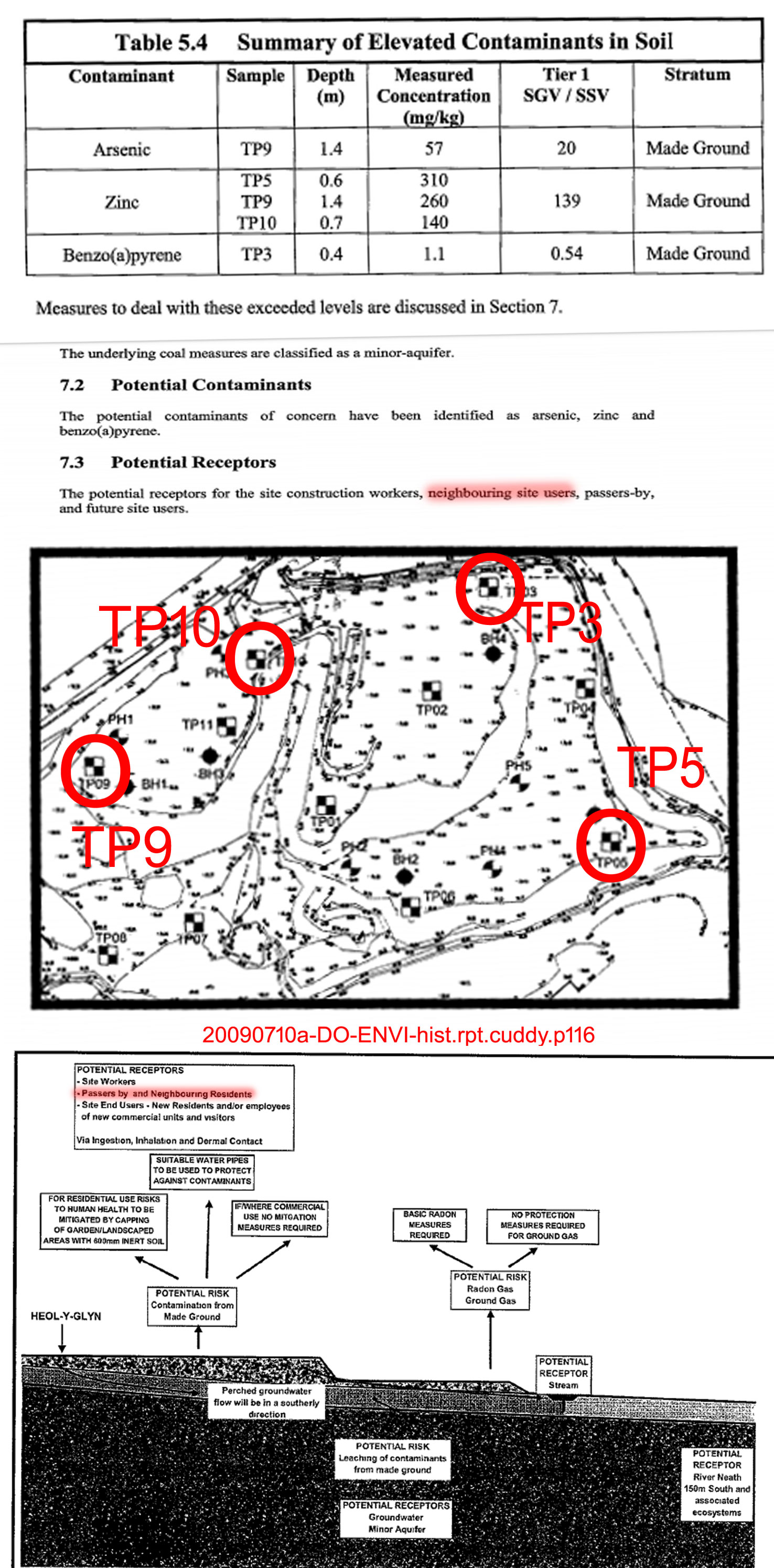
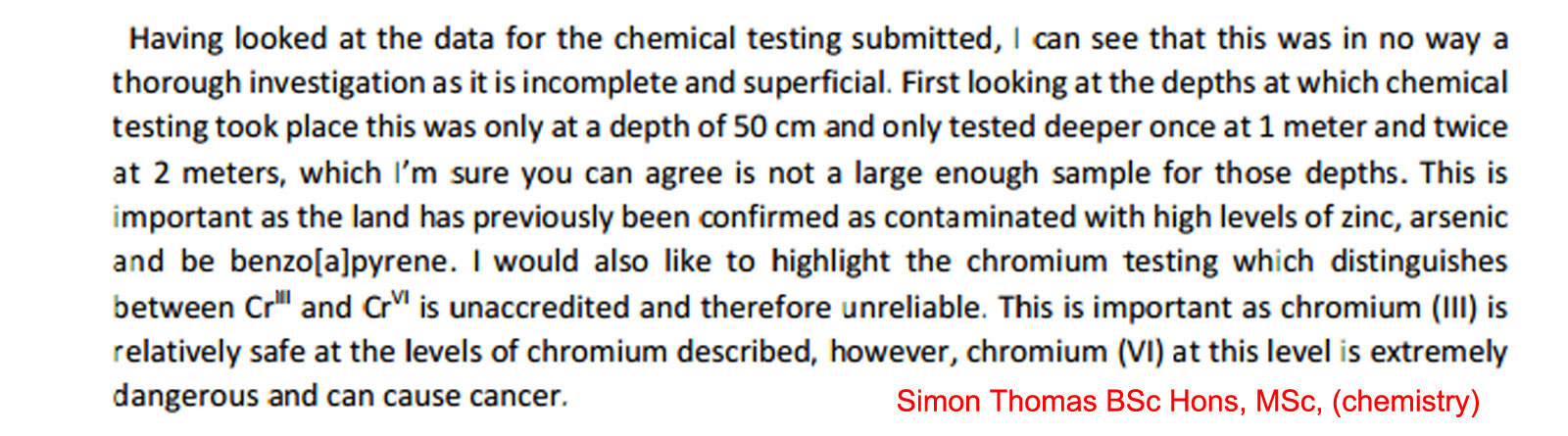
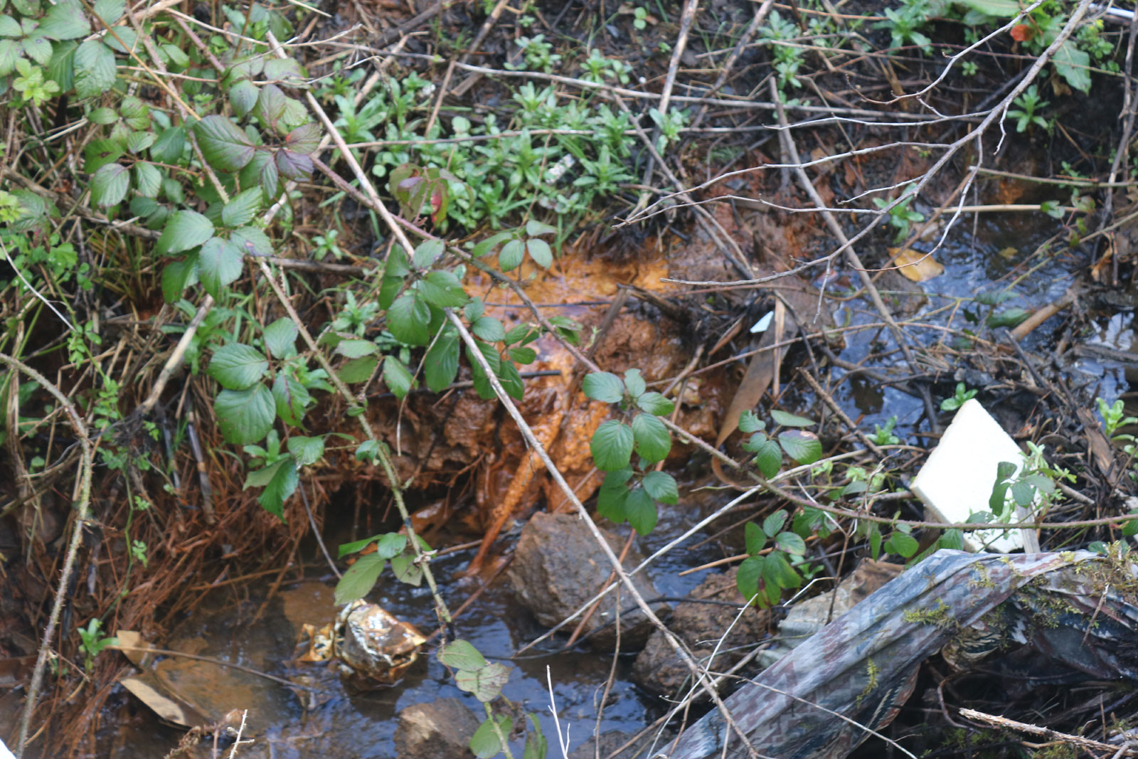
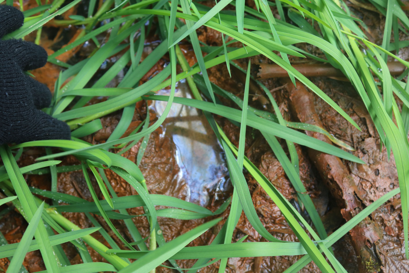
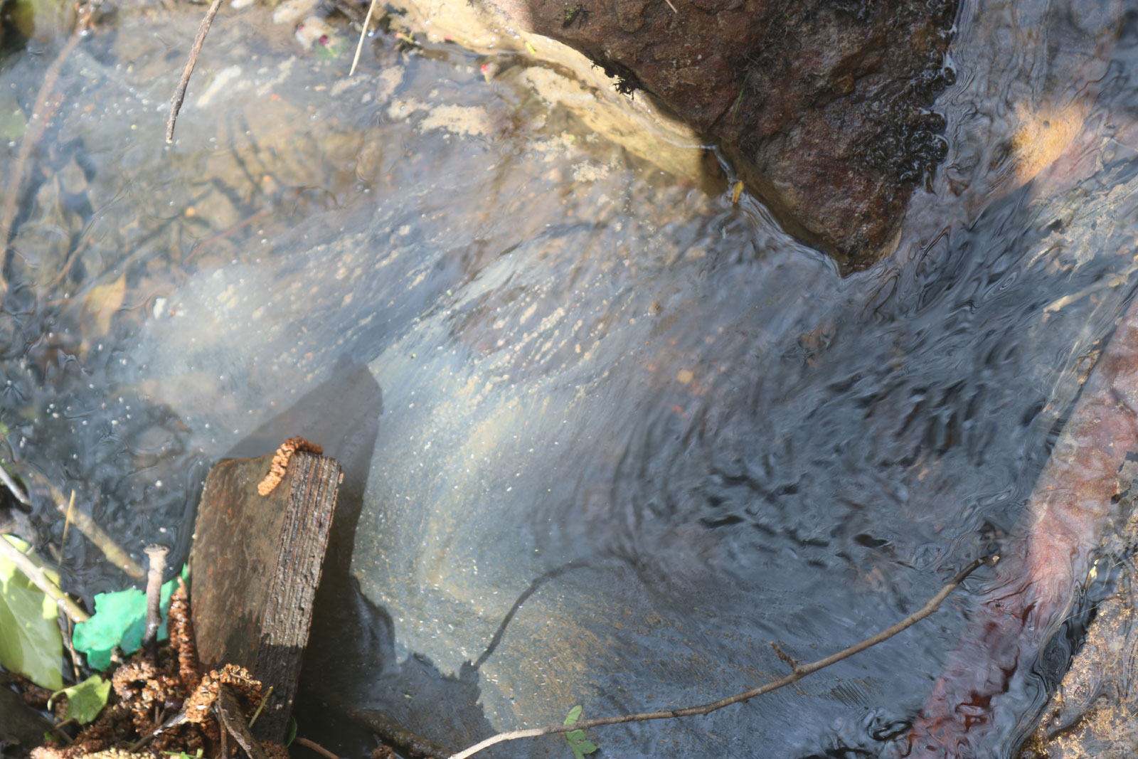
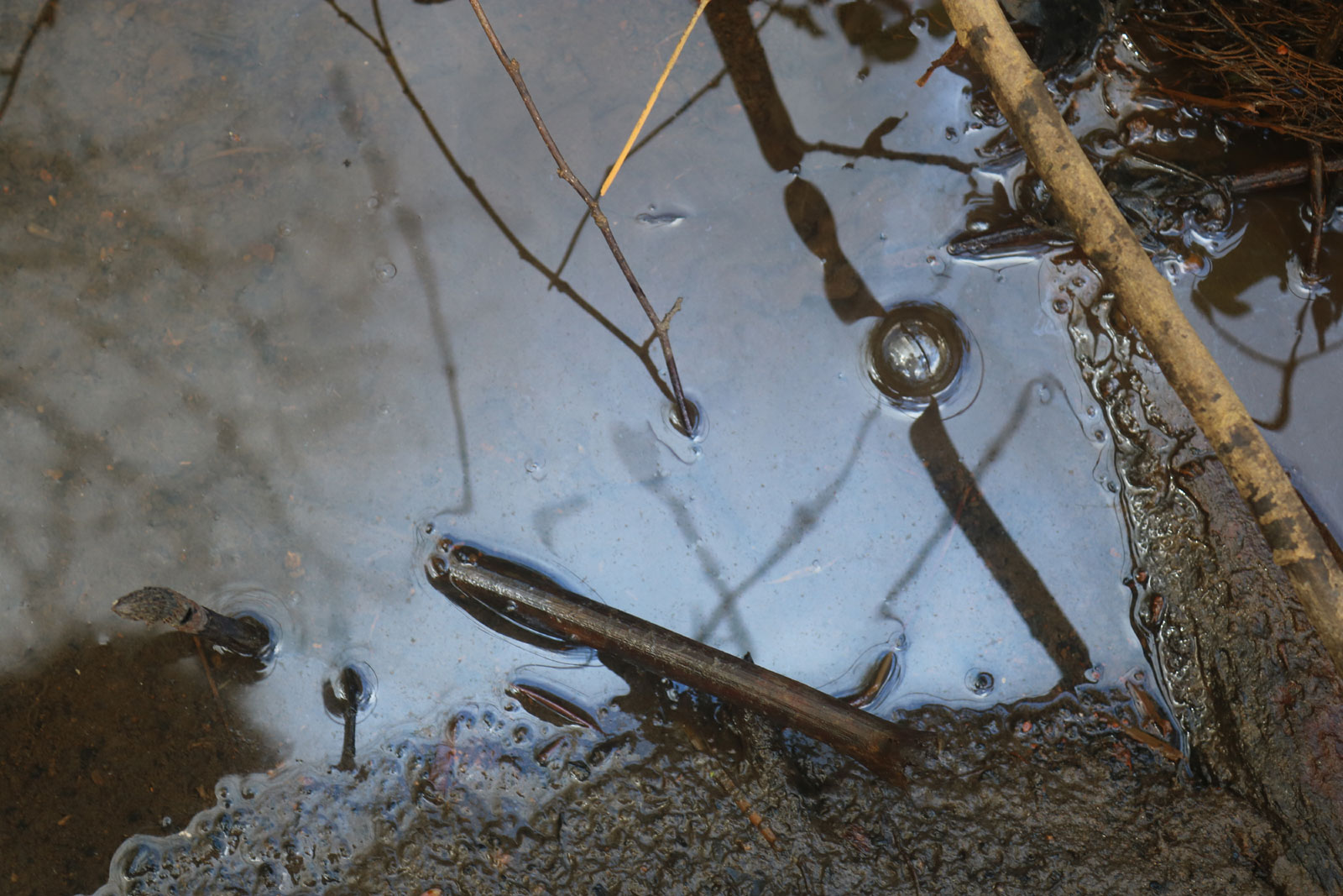
The presence of Benzo[a]pyrene (BaP) in the soil as
identified the Geo-technical and Geo-environmental report would
suggest that this may be a special site. If we look at the
following examples of councils in England, both Reading and
Slough who have discovered BaP in soil within their authority,
we will see that an above level of the contaminant
Benzo[a]pyrene is considered enough for these sites to be
designated as 'special' and for the land to referred to the
Environment Agency.
SLOUGH
CONTAMINATION - CLICK HERE
READING
CONTAMINATION - CLICK HERE
The Reading site in particular is of importance because the
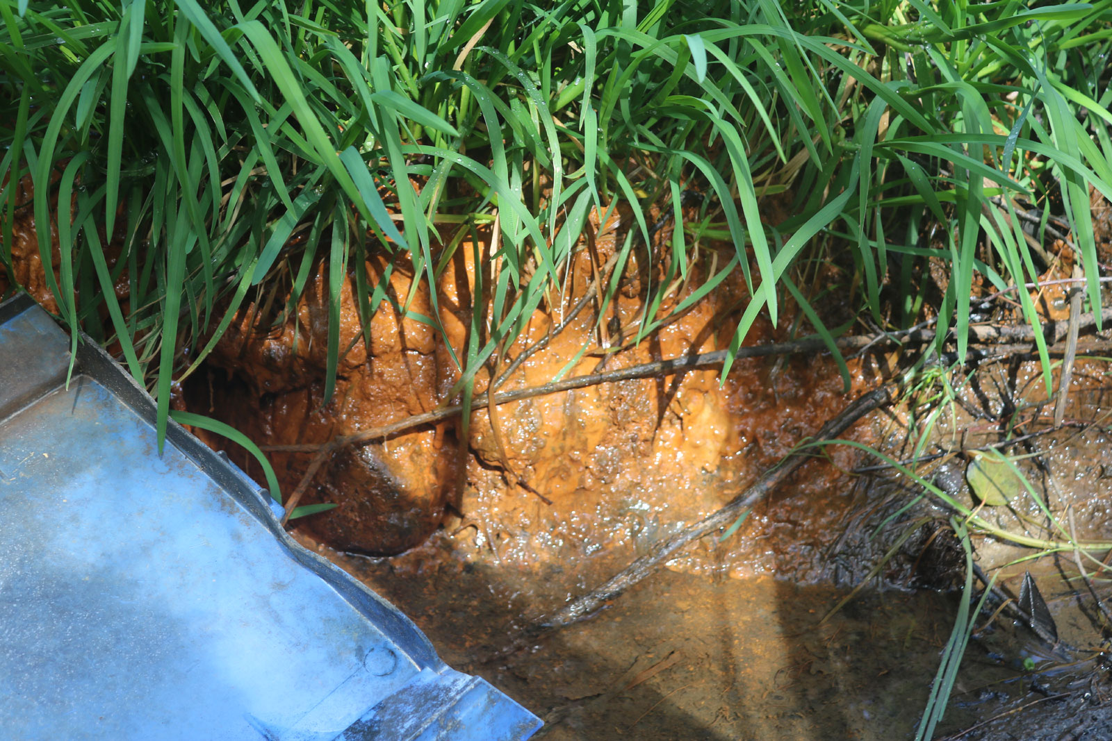
contamination is of a similar nature to the Heol y Glyn site.
The contamination at Heol y Glyn is not necessarily a modern one
because the contamination at Reading was identified as most
likely being from the tipping of domestic ash. If we refer back
to the historical usage of the site we will see that it was
known as the 'ash tip' and was at one time the local council
tip. With coal fires being the predominant method of heating
(and possibly cooking in some cases) in a coal mining area, it
is probable that the majority of landfill at the site was
domestic ash. The Reading document states that:
[the contamination] is considered more likely
to be related to historical use of the site as allotments or
possibly the previous use of the land as open ground at the rear
of houses that may have been used for domestic ash disposal."
- 20200609R-DO-reading-contam-bap
If we look again at the "Neath-Port
Talbot Council's 2005 Contaminated Land Strategy" which was the
document the planning department should have referred to for
guidance on contamination, what should have happened is that the
Planning Department should have passed the contamination
information on to Contaminated Land
Team (CLT), the CLT who should have then either informed the
Environment Agency or worked with the Planning Department to
formulate a remediation strategy. This is what the document
says..........
"When considering development proposals, the planning authorities role is to ensure that all
material planning considerations, which can include the actual or possible presence of
contamination are satisfactorily addressed. When considering an application,
where contaminated land is invloved (document spelling
mistake not ours) the planning authority will identify specific measures to be
undertaken prior to redevelopment, these requirements will be imposed by a set of
conditions attached to the planning permission. The main objective of the conditions is to
ensure suitable investigation work is carried out and that the land is remediated to a
standard that is suitable for the proposed end use."
Page 36 of this document which covers the planning process
states that sites that may be contaminated should be identified
at the earliest stage of the planning process and then throughout the development
stage and that
there should be "close liaison between the Contaminated
Land Officer and the planning officer". (There is no
evidence of any liaison between these two departments and the
Neath Port Talbot Council refuse to provide evidence of any
liaison or of any actions relating to the contamination
identified in the report.)
The overall aim of the Contaminated Land Strategy in 2008
was............
"........to identify, remove and prevent significant
harm occurring from contaminated land to people, property,
animals and the environment" (page 15)
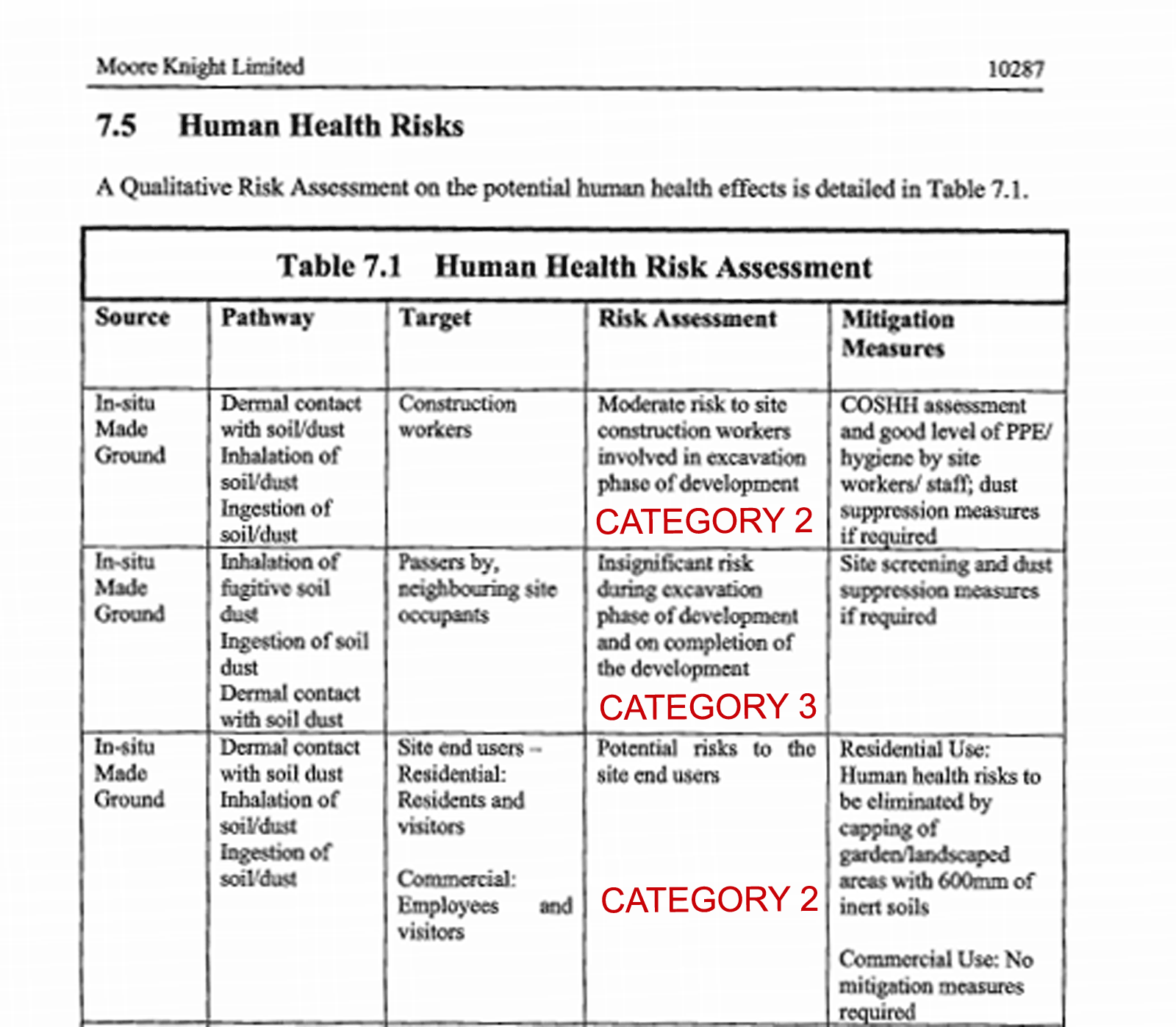
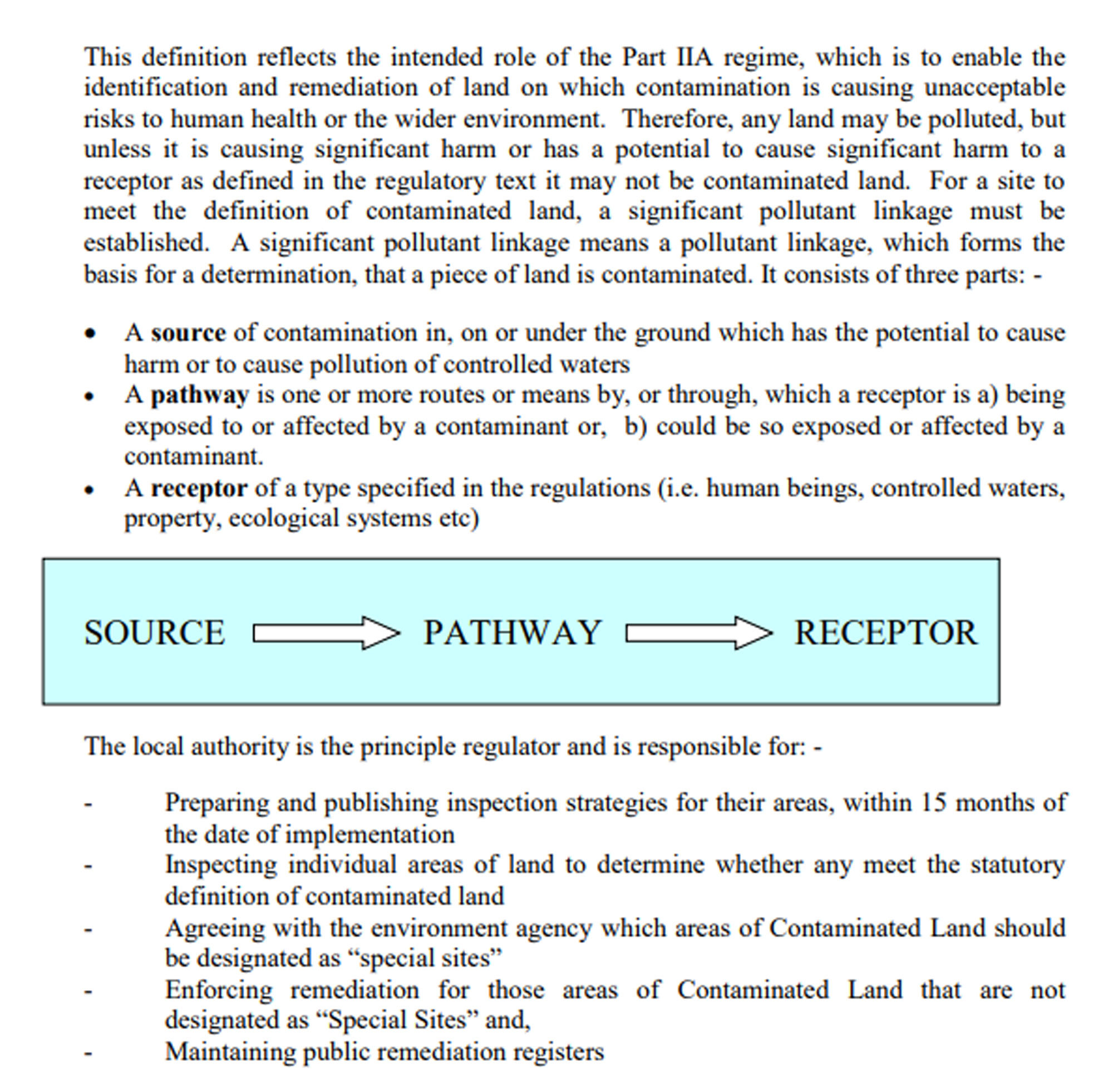
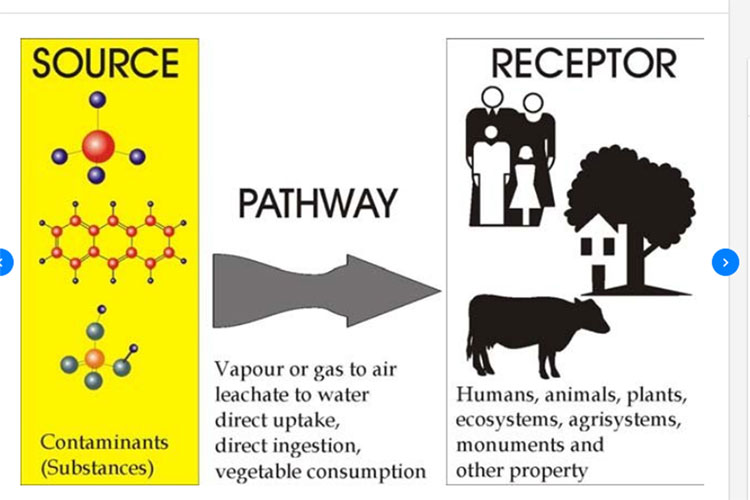
The Geo-technical
and Geo-environmental report submitted by the Cuddy Group
Agent on 26
November 2008 included a pollutant linkage (source --->
pathway ---> receptor) from the site to the
neighbouring residents. This would indicate either a
Category 1 (probable significant harm) or Category 2 (possible
significant harm) contamination which would require further
testing and a remediation strategy.
It should be noted that the maximum depth to which the
contaminated land was tested was only 1.4 metres. The tipped material at the site in some places goes down to 20
metres at a conservative estimate. It is therefore highly likely
that a far higher level of contaminants could be found at the
lower levels of the site.
The fact that the report
included a remediation
strategy and validation report is clear evidence the surveyors
considered the level of contamination to be either Category 1 or
Category 2.
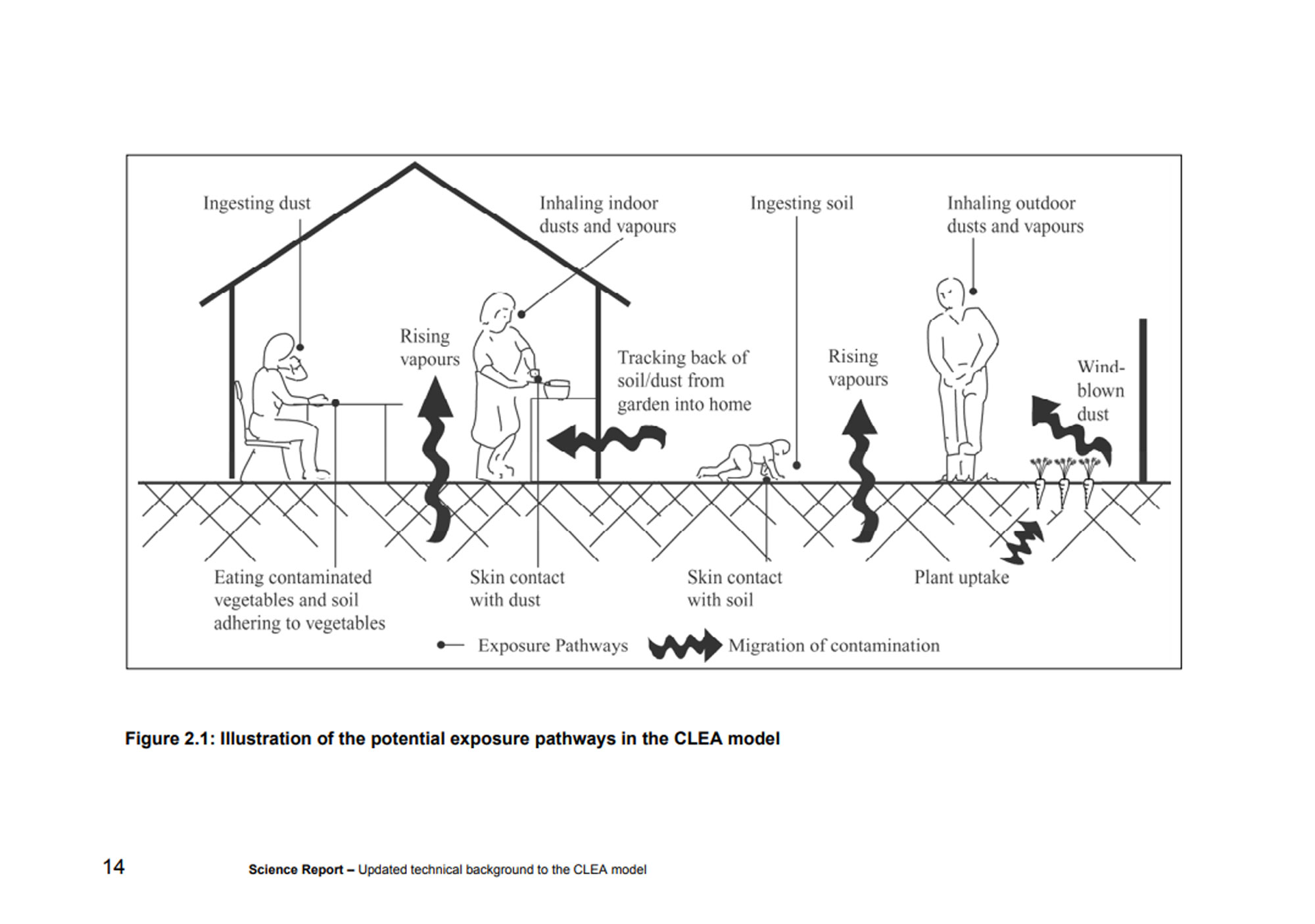
Figure 2.1, the illustration below......
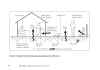
.......... is from the Environment Agency publication
"Using
Science to create a better place - Updated technical
background to the CLEA model" it shows the potential
exposure pathways for the migration of contamination from soil
to human. The figure on the right showing a man working in the
garden is particularly relevant to the Heol y Glyn site, dust
and vapours were regularly blown towards the houses of
neighbouring residents while the bottom illustration
below..........
................ shows the
direction of groundwater which flowed downhill to Brynhyfryd and
Woodland Park and is probably still contaminating home grown produce.
This is the system by which the Neath Port Talbot Council should have
judged the level of contamination.

(page 7 - NPTC 2005 Contaminated Land Strategy)
That a pollutant
linkage from the source at the Heol y Glyn site to the
receptors, construction workers, future residents, neighbouring residents (Brynhyfryd, Woodland Park,
Heol y Glyn, Waun Gron and the Inter Valley Road) was
identified, places the
contamination as either Category 1 (probable significant
harm) or Category 2 (possible significant harm). The inclusion
of this information in the Geo-technical and Geo-environmental
report provides
evidence that the land should have been remediated or at least
further testing should have taken place to identify whether or
not it is a special site. If we refer again to the Environmental
Protection Act 1990 (b).
(b) of enabling the authority to decide whether any such land is
land which is required to be designated as a special site.
There is no evidence that the Neath-Port Talbot Council did
this. |