|
GLYNNEATH & ABERPERGWM CIRCULAR WALK - 6.5 miles |
|
|
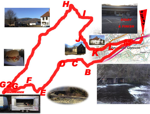
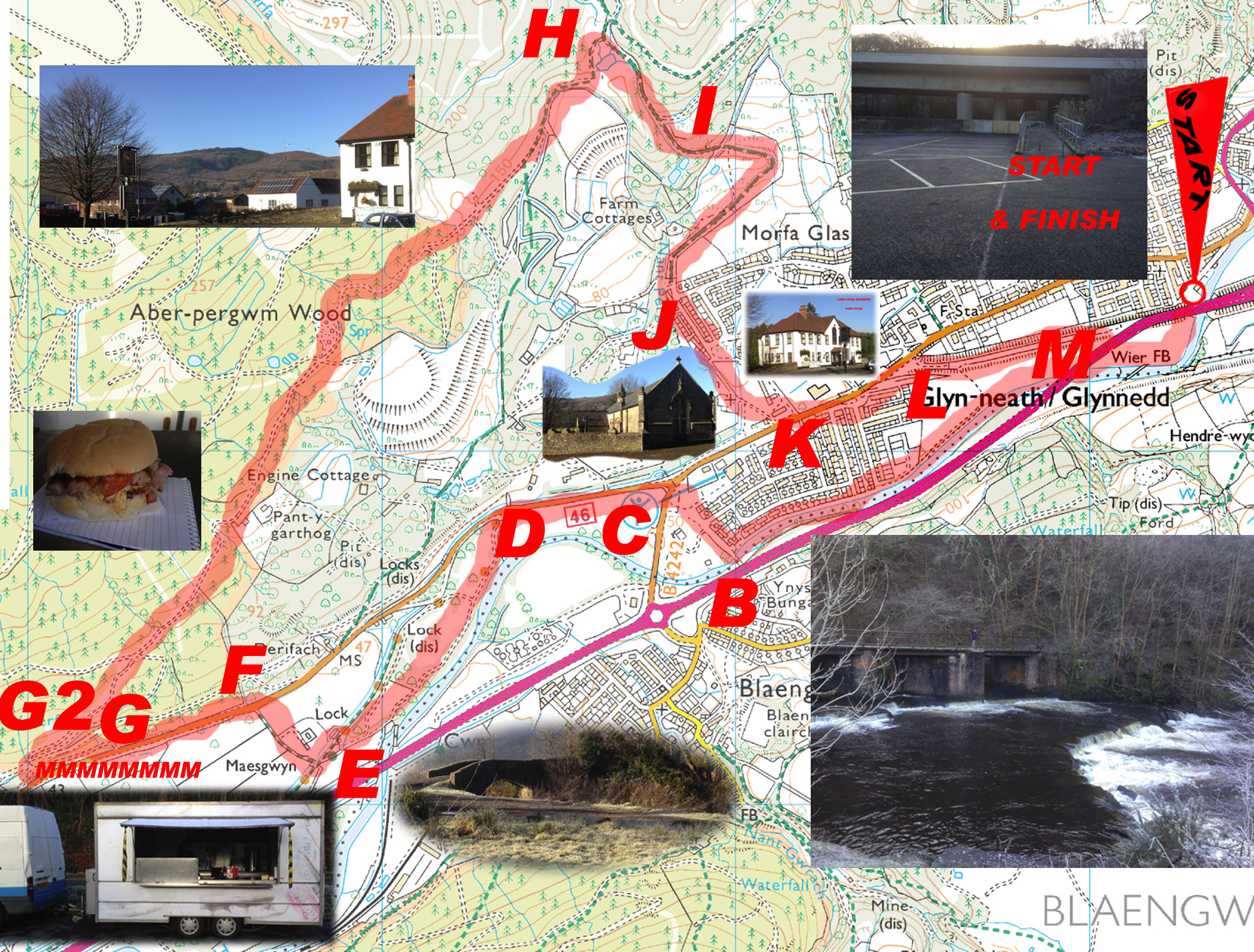
GLYNNEATH-ABERPERGWM-CIRC-6.5HO-SN.883064.SA11.5DB GARMIN - ROUTE IMAGE - PRINTABLE DIRECTIONS OVERVIEW - A nice walk that does get a little muddy in the middle. About half way between point G2 and point H please be aware that you are entering a motorsport area with the possibility of motorcycles and cars using the same track. The path from I to J is a concrete road and will be extremely slippery and dangerous in icy conditions.
|
|
|
DISTANCE 6.5 miles
ELEVATION - Hilly - 597 feet SEVERITY of TERRAIN - Off Road (muddy in parts) START - Glynneath Town Centre Car Park GRID REF - SN 883 064 POSTCODE - SA11 5DB (Oddfellows Street) PLACES OF INTEREST - Neath Canal - Lime Kiln - Aberpergwm Wood - St Cadoc's Church, Aberpergwm LAST WALK UPDATE - 16 Dec 2014 WALK BLOG & MORE PHOTOS - CLICK HERE DIRECTIONS TO START - Drive through Glynneath town until you reach the Co-operative Supermarket - turn into Oddfellows Street opposite (signposted P = parking) the Co-op and follow it to the end. |
CLICK HERE FOR A MORE DETAILED IMAGE OF THE ROUTE
|
|
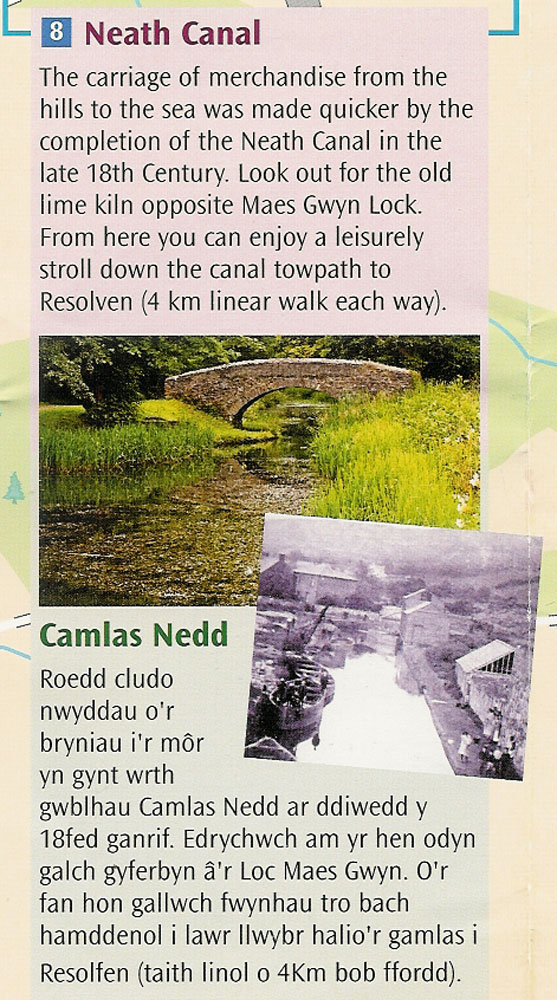
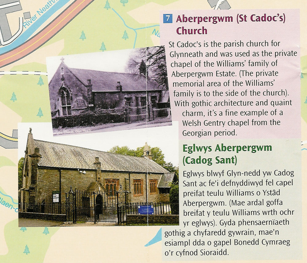
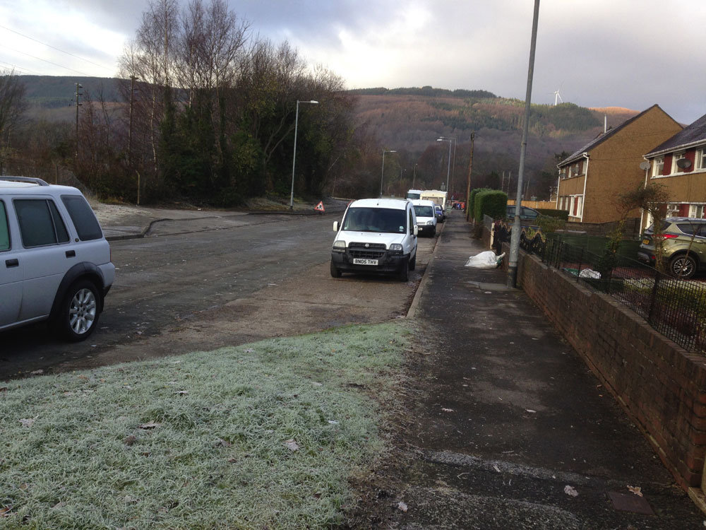
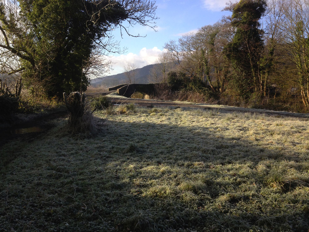
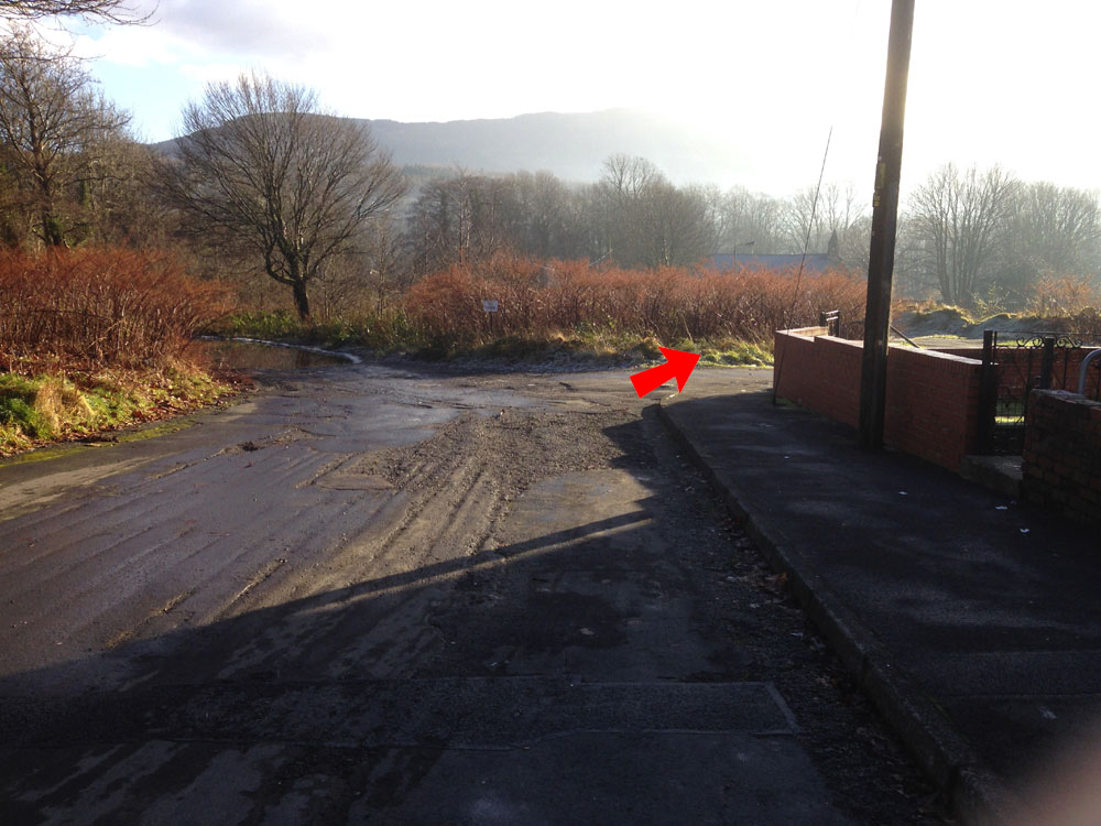
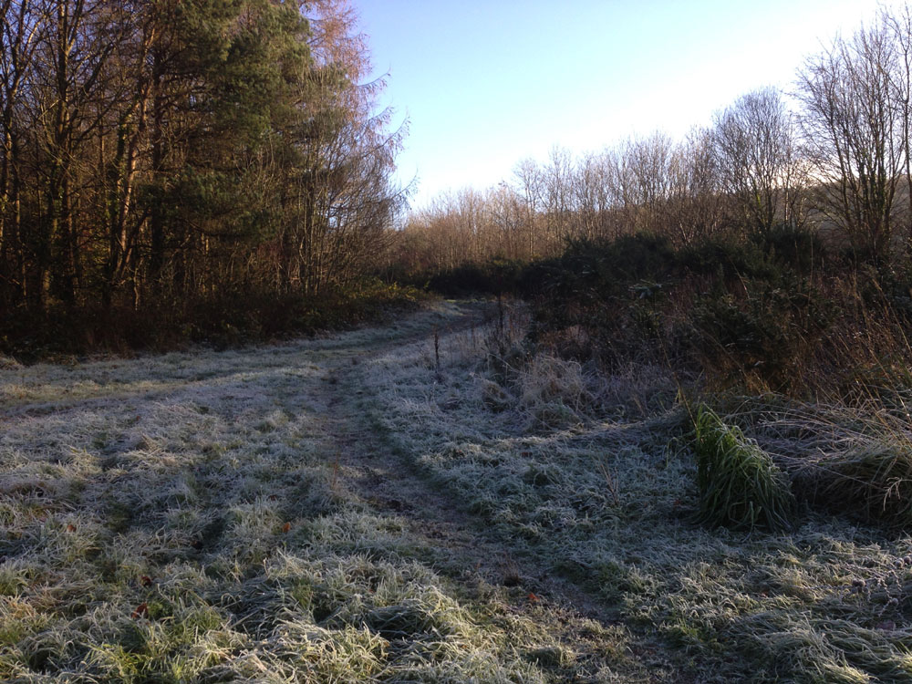
THE WALK START - Glynneath Town Centre Car Park - Take path under road bridge and follow the river to the end of the path looking left you will see the subway under the road to Cwmgwrach, looking right you will see a road.............. B - Turn right and follow this road. - PHOTO CLICK HERE C - At the end of this road turn right and then immediately left onto the old Resolven road B4242. Follow this road for about 400 metres and on your left there will be a tarmac path leading off to the left. D - Turn left here and rejoin the river path where it leaves the road. Follow this path and at the point it turns from tarmac to gravel, turn right. As soon as you arrive at an open grassy space just before the canal bridge if you immediately turn right and follow the tree line for about 10 metres just before you hit the canal path there is a massive lime kiln that is worth a look. E - At the point where this path meets the canal, cross bridge onto a lane. - PHOTO CLICK HERE F - at the end of the lane when you reach the B4242 again turn left and proceed along the grass verge. MMMMMMMM - Marshalls is about 200 metres on the same side. There is no pavement here but a generous verge that you can walk on. Marshalls is normally open until about 2.00pm. To pre-order your Marshall's meal please ring 07974 602 681. G - Continue past the Marshall's layby and almost directly opposite the end cross the road and walk up the forestry track G2 - After about 400 metres turn right onto a forestry track. The track immediately forks, take the left more prominent fork. Continue along this track, it will come to a wide forestry well used forestry road that - continue across this road and follow the track to point H. It is from this point onwards that you will note tyre tracks and rutted areas, This area is used for Motorsport, in particular motorbike scramblers and rally cars and this is where you will get muddy. H - On reaching the path/bridleway junction turn right down the hill, there should be a stream with cascades on your right, The path continues through a gate next to the stream. I - At the stream junction, leave the stream and continue down the concrete road which which lead you back into civilization. Continue straight on and when the road turns left fork right towards the church. J - Head down the lane to St Cadoc's church. At the end of the lane you pass through the gates of the old Aberpergwm House. - PHOTO CLICK HERE K Turn left at the road. Cross over the road at some stage then just after the Lamb & Flag and before the speed camera look for a grassy path that goes off at a 2 o clock angle on the right. - PHOTO CLICK HERE L -Take this path and within about 100 metres you should arrive at the 'road to nowhere'. this is the old bypass that is now closed off at either end. Walk the length of the road and just before the end on the right hand side......... M - ..... cut back down a wide rough path and this will take you back down to the river path, follow the river path back to the finish. |
|
|
THE WALK ON GARMIN
|
|