|
DAI'S TOUR OF NEATH-PORT TALBOT |
|
The county of Neath-Port Talbot is a strange affair. One would think looking at the name it's two towns Neath and Port Talbot joined together, but it is more than that. It is a large chunk of the Swansea Valley and also has parts of Ammanford included within its boundary. I've lived in Neath-Port Talbot for most of my life, however it hasn't always existed as Neath-Port Talbot. I was born in the town of Neath because the hospital there had the nearest maternity ward to the town of Port Talbot, both of which were in the county of Glamorgan. While I was at school, the town of Port Talbot changed to the Borough of Afan and Glamorgan was split into three parts, south, mid and west, both Neath and Port Talbot (Afan) were included in West Glamorgan along with Swansea and Lliw Valley. Lliw Valley was the strangest of places, it consisted of two parts which were not joined together. When I was an older child of around 40, the Welsh or maybe it was the British Government decided that Neath and Port Talbot should become a county swallowing up one of the parts of Lliw Valley, the other was eaten by Swansea. Historically my family have always lived in Neath, my ancestors are credited with building some of the towns major landmarks such as Victoria Gardens, Llantwit Cemetery, Empire Cinema (demolished) as well as some in Port Talbot (Twelve Knights Hotel). In 2016 I started to link walks together in the direction of Neath then I thought it would be a marvellous idea to make a tour of the county of Neath-Port Talbot, to see and learn about the places in which I and my family have lived and worked in, to visit new places and to learn about my locality, who lives here, what grows here, how and where my forefathers worked, I have a thirst for knowledge and I want to learn about anything and everything. You may take inspiration or learn something from my tour, you may not, I hope you do. PLEASE NOTE - The routes listed on this page have been walked in the past but may have altered since last walked. They are only listed on this page as a personal record for myself and hopefully to provide inspiration to others. if you attempt to follow in my footsteps, please note that you should check beforehand whether or not a walk is suitable for your ability. |
|
STAGE 1 - WALKS 1-12, GLYNNEATH to PORT TENNANT on the NEATH & TENNANT CANALS STAGE 2 - WALKS 12-18 - WALES COAST PATH STAGE 3 - WALKS 18-21 - RIVER OGWR to OGWR RIDGEWAY PATH STAGE 4 - WALKS 22-24 - OGWR RIDGEWAY PATH to MARGAM ABBEY |
STAGE 1 - WALKS 1 - 12 - GLYNNEATH to PORT TENNANT on the NEATH & TENNANT CANAL
Walk 1 (Stage 1) - Glynneath - Glynneath Leisure Centre
|
Info to follow |
Walk 2 - Glynneath Leisure Centre to Rheola market (now moved to Resolven)
|
|
Info to follow |
Walk 3 - Rheola Market to Farmers Arms, Resolven
| Info to follow |
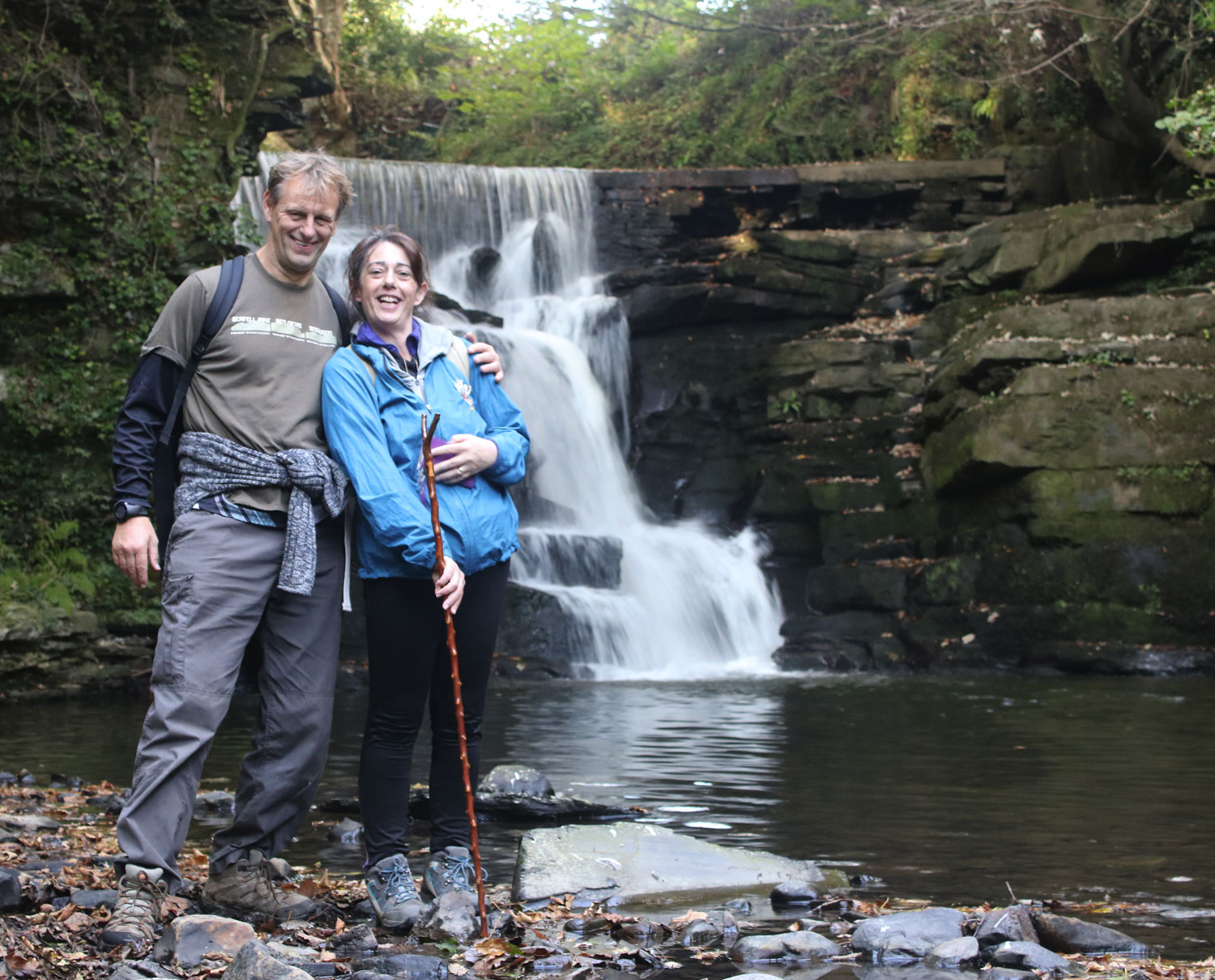
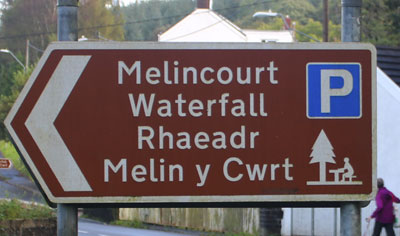
Walk 4 - Farmers Arms to Melincourt Waterfall
| Info to follow |
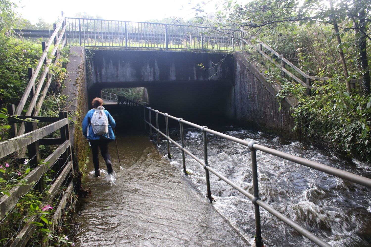
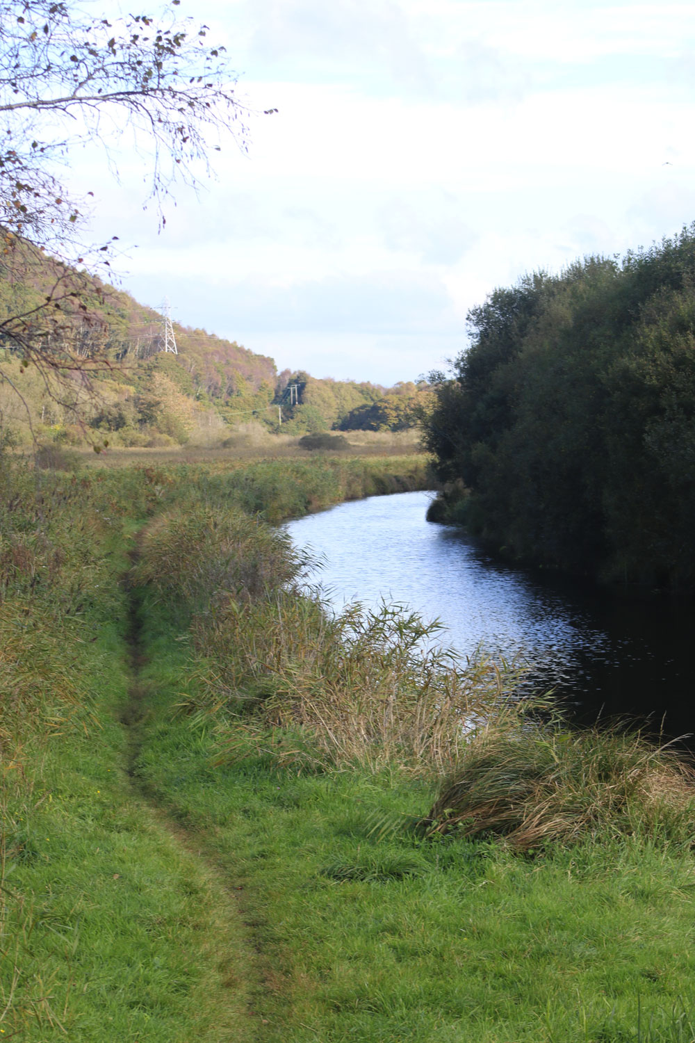
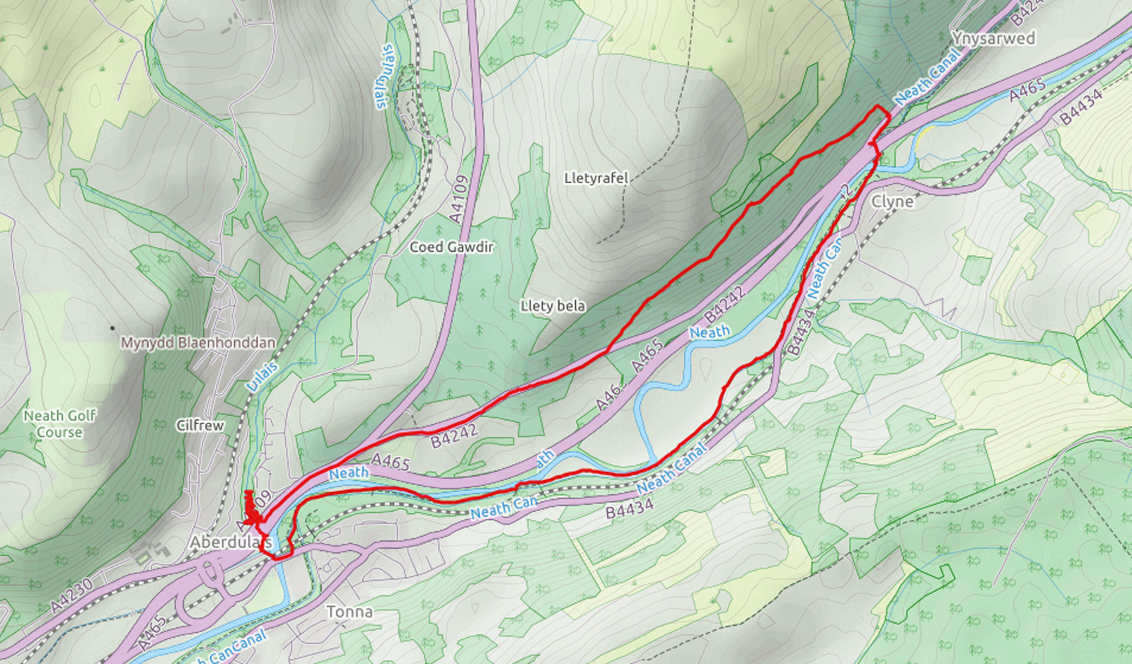
Walk 5 - MELINCOURT to YNYSARWED - 4UD-SN821019-SA11-4AP - walk date 30/09/2016 - CLICK HERE FOR MORE INFO
located on the B4434 between Resolven and Neath

|
Parking in the Melincourt car park this route makes its way to the canal over
the railway line, under the dual carriageway and over the river. The underpass can be flooded after heavy rain so timing this
walk correctly is of importance, we didn't. The path joins the canal at Abergarwed
where the canal starts again after a short break. Following the canal for
approximately 1 mile the route cuts back through the village of Ynysarwed
passing by two small waterfalls which can be viewed from the roadside. It then
loops back to Abergarwed through the forestry before retracing the
approach route and the crossings.
CLICK TO DOWNLOAD .GPX FILE FOR THIS ROUTE
|
. . |
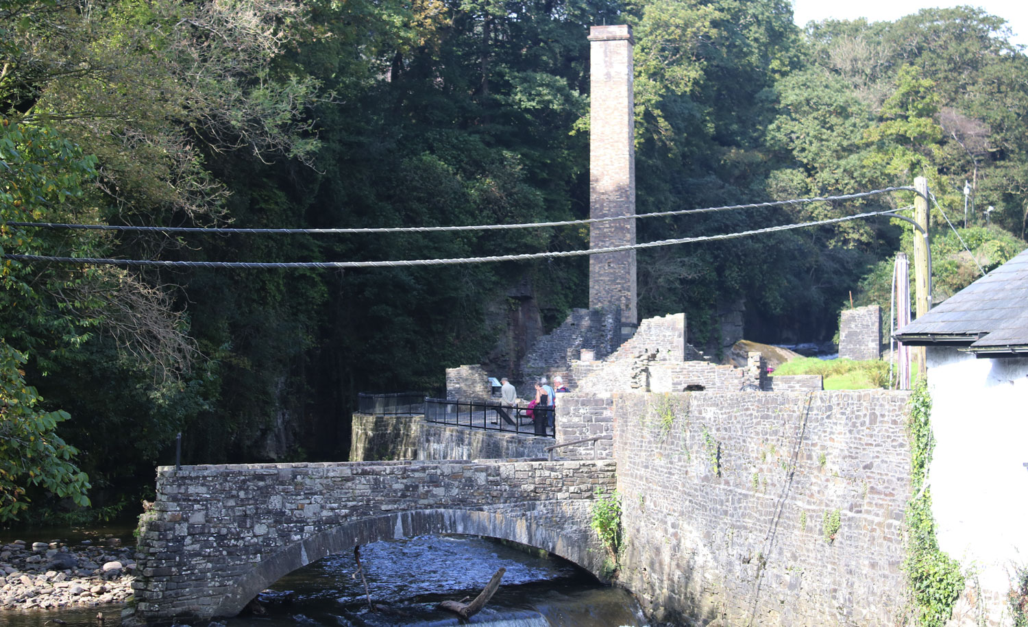
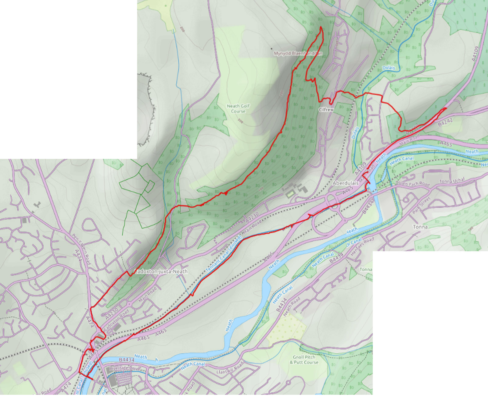
Walk 6 - YNYSARWED to ABERDULAIS FALLS - 6UD-SN803012-SA11-4DE - walk date 4/10/2016 - CLICK HERE FOR MORE INFO
On the B4242 at Ynysarwed between Resolven and Aberdulais
|
A circular route along the Neath canal from Ynysarwed to the Aberdualis
basin. Stopping off at the Aberdulais Falls, a National Trust run facility
is an option, there is also a cafe here that you can visit without paying
the entrance fee. This route then returns through the forestry.
WARNING - The descent from the forestry beside the stream on the last part of this walk is quite steep and very slippery when wet. If in doubt stick to the road and avoid the forestry section. |
. . |
Walk 7 - ABERDULAIS FALLS to NEATH - 6UD-SS772994-SA10-8HA - walk date 6/10/2016 - CLICK HERE FOR MORE INFO
|
A circular route along the Tennant Canal to Neath, there is an option to stop for coffee in Burger King. The route climbs back through the Rhyddings, Cadoxton and Craig Gwladys Country Park. |
. . |
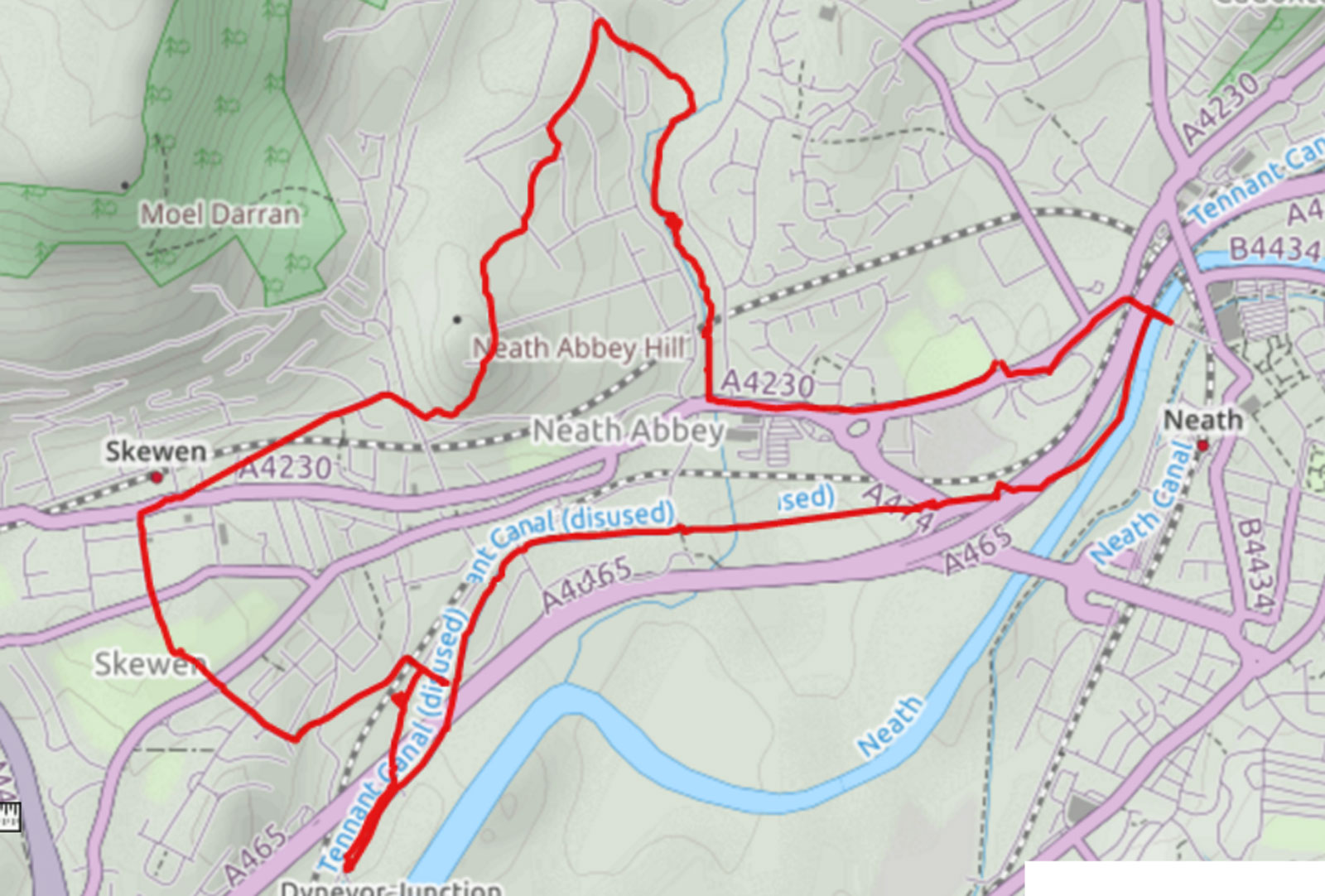
Walk 8 - NEATH to SKEWEN 6UD-SS745977-SA10-7FB - walk date 13/10/2016 - CLICK HERE FOR MORE INFO
|
A 6 mile walk from Cwrt Herbert playing fields along the Tennant canal through Neath Abbey to Skewen, passing through Skewen Memorial Park. There is an option to stop at Cresci's Cafe for a coffee or meal. Heading up through Longford and back down to Neath Abbey via the river Clydach. (illustrated waterfall on this river). |
. . |
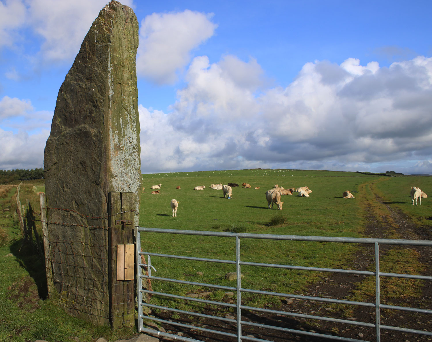
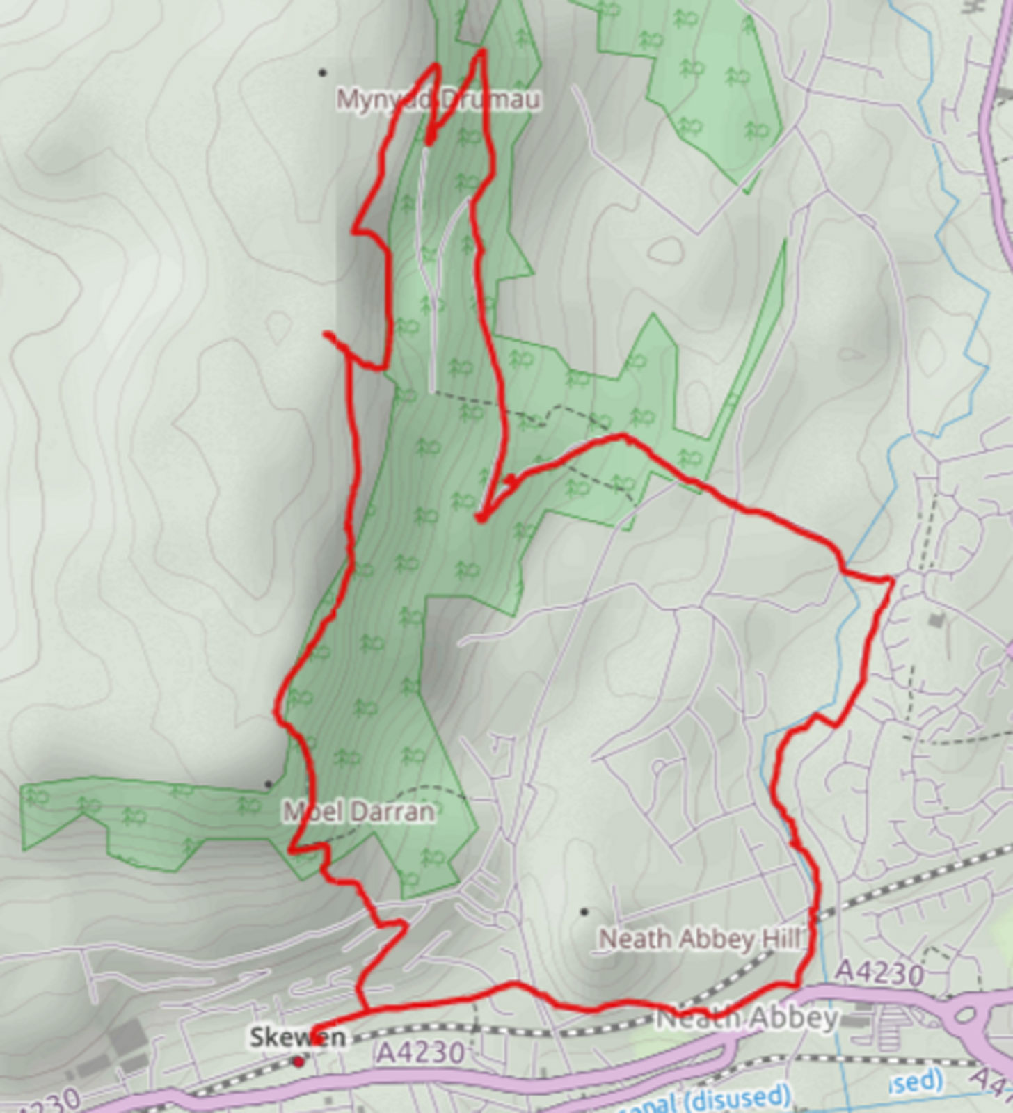
Walk 9 - CARREG BICA & DRUMMAU MOUNTAIN - OPTIONAL SATELLITE WALK 6HD-SS724975-SA10-6HF - walk date 15/10/2016 - CLICK HERE FOR MORE INFO
|
Carreg Bica is a standing stone on Drummau Mountain, above Skewen. It is
one of Neath-Port Talbot's oldest structures so it is worth deviating from
the canal to visit this site.
WARNING - It is best to avoid taking dogs on this route, it will normally pass through a field of cows who have been known to be aggressive towards people with dogs. |
. . |
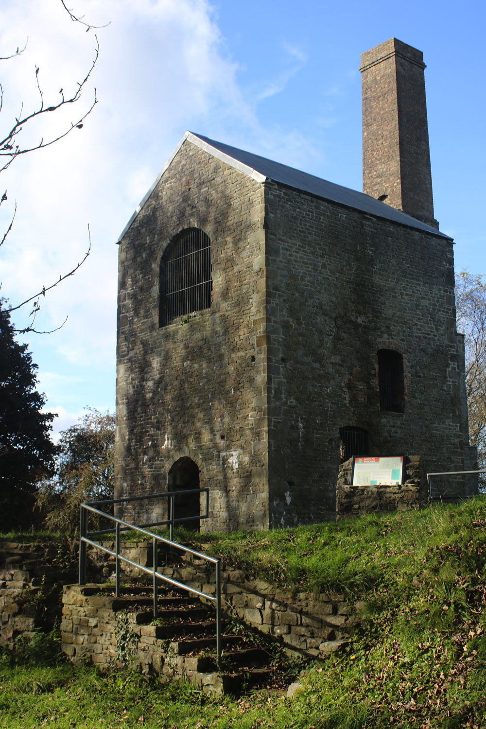
Walk 10 - GO SHOPPING OUTDOORS - OPTIONAL SATELLITE WALK 8UO-SS724975-SA10-6HF - walk date 18/10/2016 - CLICK HERE FOR MORE INFO
|
|
Just over the border in neighbouring Swansea is the giant leisure superstore Go Outdoors, as the store is situated less than two miles from the county boundary you may want to take the opportunity to travel over Neath Port Talbot county to the store and to visit Scott's Pit (illustrated), a derelict coal mine in nearby Heol Las. |
. . |
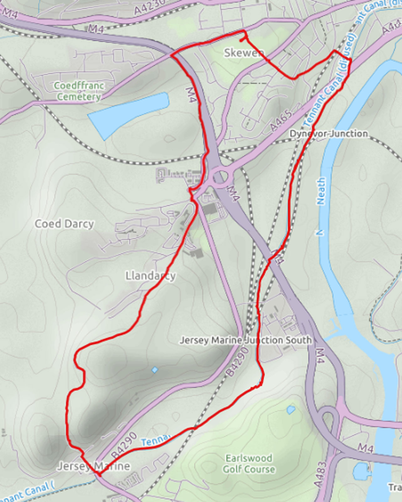
Walk 11 - SKEWEN TO JERSEY MARINE 6UE-SS723970-SA10-6LD - walk date /10/2016 - CLICK HERE FOR MORE INFO
|
Parking in Skewen Memorial Park we did a 6.2 mile loop from Skewen to Llandarcy, the back road to Jersey Marine and back again on the Tennant canal. |
. . |

A swan flying in the direction of Swansea
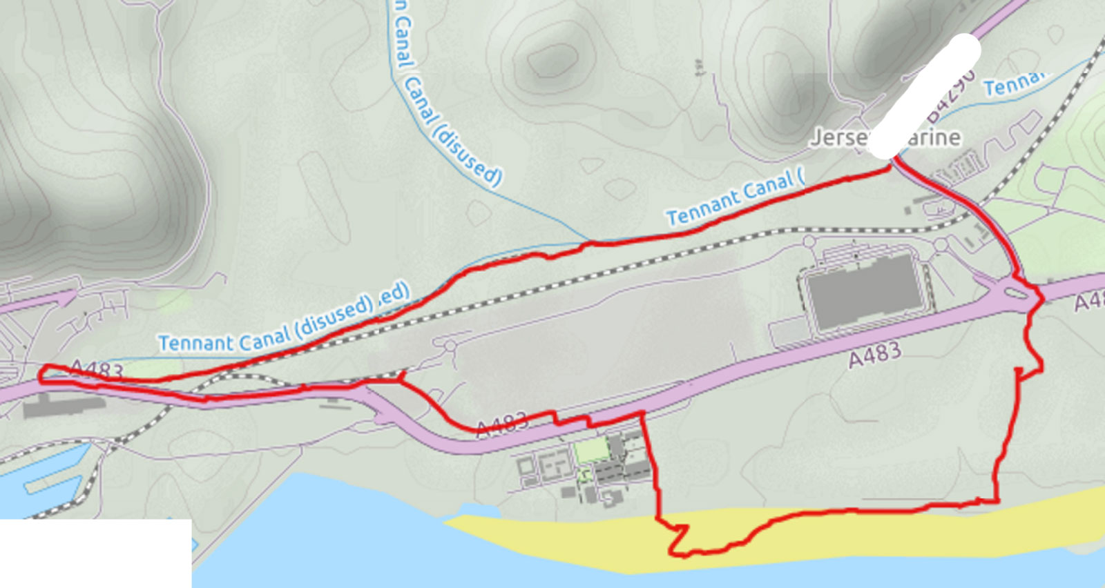
Walk 12 - JERSEY MARINE to PORT TENNANT - 6FE-SS711939-SA10-6JJ - walk date 29/10/2016 - CLICK HERE FOR MORE INFO
*****END of STAGE 1 START OF STAGE 2 *****
|
Parking in the village of Jersey Marine this loop heads down the Tennant canal and the finish of stage 1 at the aptly named Port Tennant. The route heads back to Jersey Marine via the dual carriageway and Jersey Marine beach. |
. . |
STAGE 2 - WALES COAST PATH
Walk 12 - JERSEY MARINE to PORT TENNANT - 6FE-SS711939-SA10.6JJ
***** END of STAGE 1 START OF STAGE 2 *****
|
|
Parking in the village of Jersey Marine this loop heads down the Tennant canal and the finish of stage 1 at the aptly named Port Tennant. The route heads back to Jersey Marine via the dual carriageway and Jersey Marine beach. |
. . |
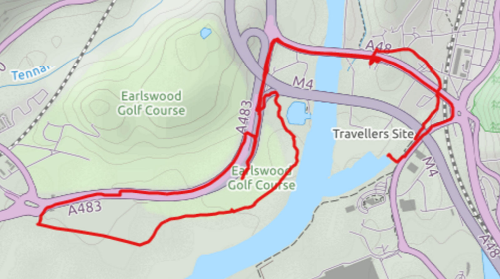
Walk 13 - JERSEY MARINE to BRUNEL DOCK 5UE-SS736935-SA11-2HZ - walk date 1/11/2016 - CLICK HERE FOR MORE INFO
|
Starting near the Neath Port Talbot council offices at 'The Quays' and Brunel Dock this route travels to Jersey Marine on the cycle path then cuts back around the back of the golf course (please ignore the walk onto the golf course, I could have sworn there was a short cut there) and the high tide line alongside the river & beach. |
. . |
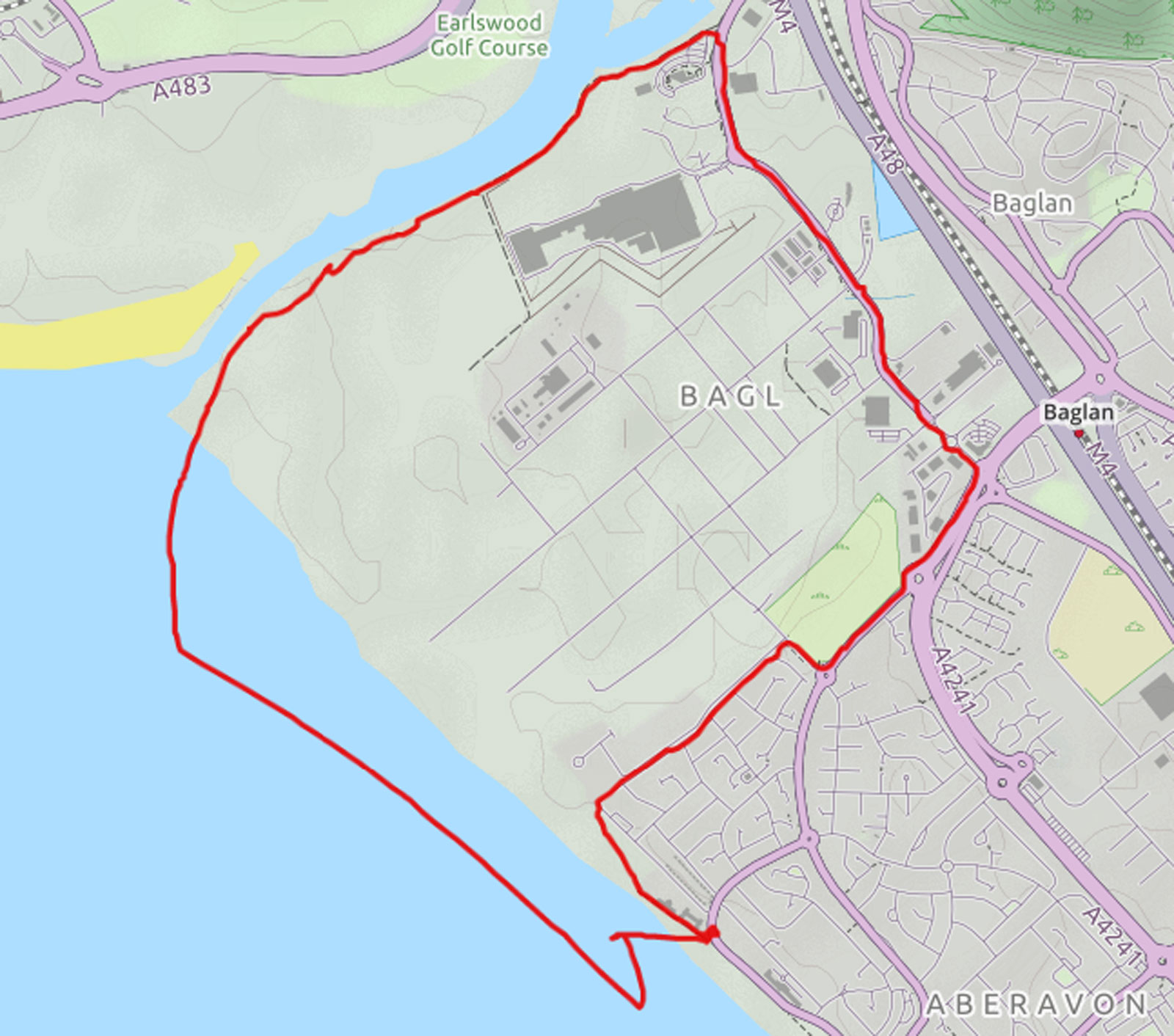
Walk 14 - BRUNEL DOCK to FRANCO'S 6FE-SS739901-SA12-7NX - walk date 7/11/2016 - CLICK HERE FOR MORE INFO
|
Parking near Franco's this route travels to the Brunel Dock via the Baglan Energy park. Once at the Brunel Dock your can either follow the coast path back to Franco's or continue following the river to the Ferry Bend, you should avoid this route when the tide is in, stay on the coast path to the beach. There is the option of a restaurant meal or straight fish & chips at Franco's, a couple of hundred yards away you also have Remo's, another restaurant / coffee shop with a great selection of ice cream. |
. . |
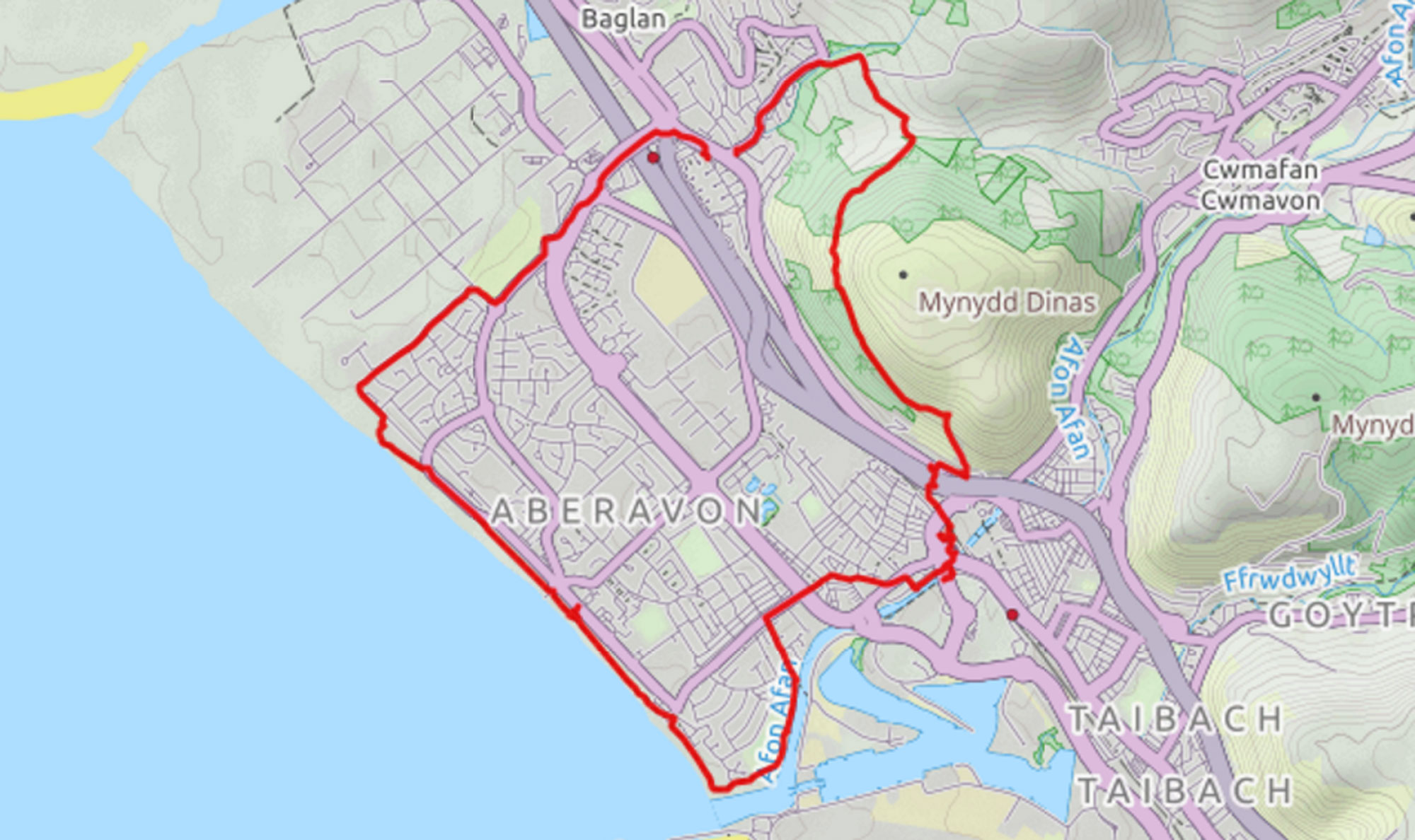
Walk 15 - FRANCO'S to PORT TALBOT -SS739901-SA12-7NX - walk date 12/11/2016 - CLICK HERE FOR MORE INFO
|
The route map will show that we parked in Baglan, we did this for convenience. This route is best tackled from Franco's, or other location on Aberavon seafront. The route heads up to Port Talbot, paying homage to Dic Penderyn in St Mary's Church before traversing Mynydd Dinas. During the walk you pass by 3 locations from the film Twin Town. Once off the mountain the route travels past Baglan Church and back to the beach. |
. . |
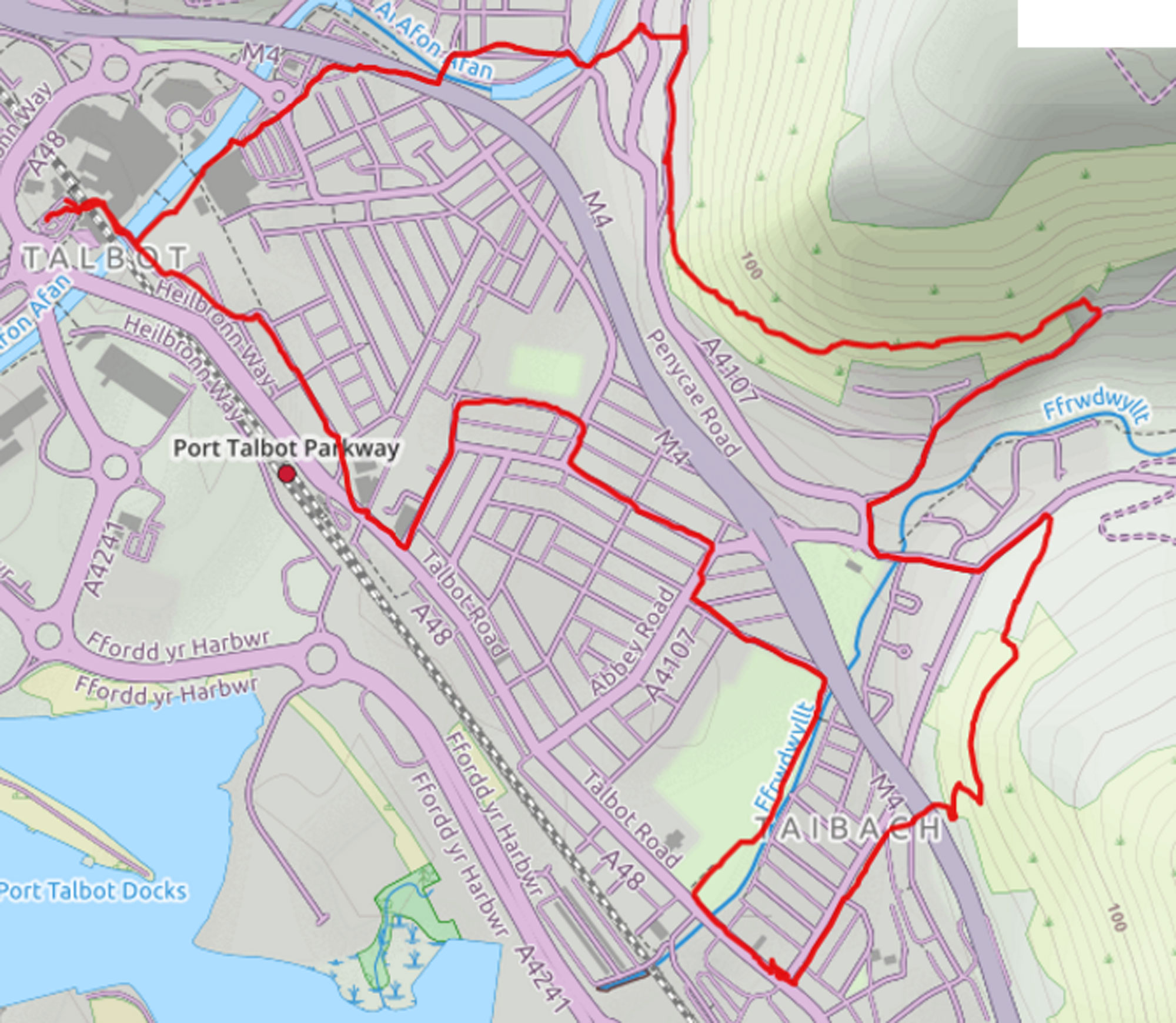
Walk 16 - PORT TALBOT to TAIBACH -SS763900-SA12-6LE - walk date 20/11/2016 - CLICK HERE FOR MORE INFO
|
Starting at the St Mary's Church pay & display in Port Talbot this route makes its way to Taibach lights via Station Rd, Plaza Cinema, Aberavon RFC, the Plough & Taibach Memorial Park. Once at the lights head up towards Goytre and cut up to the upper Wales Coast path just before the Taibach Workingmen's Club. Following the WCP to the Tesco's garage it follows the river back to the car park. |
. . |
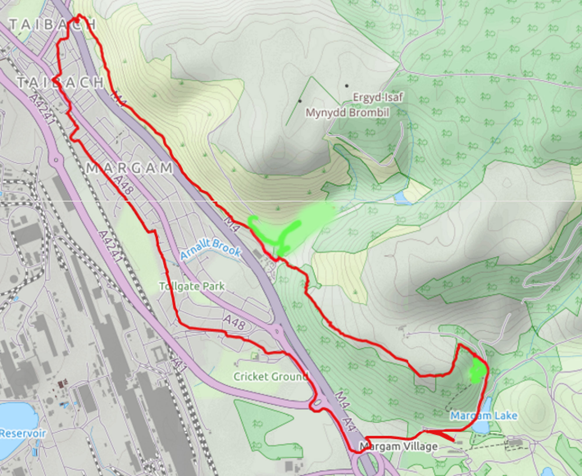
Walk 17 - TAIBACH to MARGAM ABBEY - walk date 22/11/2016 - CLICK HERE FOR MORE INFO
|
Info to follow
Garmin route saved is not suitable. |
. . |
Walk 18 - MARGAM to AFAN CYNFFIG (RIVER KENFIG) - walk date 10/12/2016 - CLICK HERE FOR MORE INFO
Garmin route corrupted - someone left it on, and the car journey was added to the walk.

|
Info to follow
Garmin route corrupted - someone left it on, and the car journey was added to the walk. |
. .
|
STAGE 3 - - RIVER OGWR to OGWR RIDGEWAY PATH
Walk - 19 AFAN CYNFFIG to MAWDLAM - walk date 10/1/2016 - CLICK HERE FOR MORE INFO

|
Info to follow |
Walk - 20 - MAWDLAM to PYLE - walk date 17/1/2016 - CLICK HERE FOR MORE INFO
Garmin route corrupted - someone left it on and the car journey was added
to the walk.

|
Info to follow |
. .
Garmin route unavailable |
Walk - 21 PYLE to PARC SLIP - walk date 23/1/2016 - CLICK HERE FOR MORE INFO
|
|
Info to follow | . . |
STAGE 4 - OGWR RIDGEWAY PATH to MARGAM ABBEY
Walk - 22 - PARC SLIP to OGWR RIDGEWAY - walk date 5/2/2016 - CLICK HERE FOR MORE INFO
|
Info to follow | . . |
Walk 23 - OGWR RIDGEWAY to MARGAM MOUNTAIN - walk date 6/7/2017 - CLICK HERE FOR MORE INFO
|
Info to follow | 23. . |
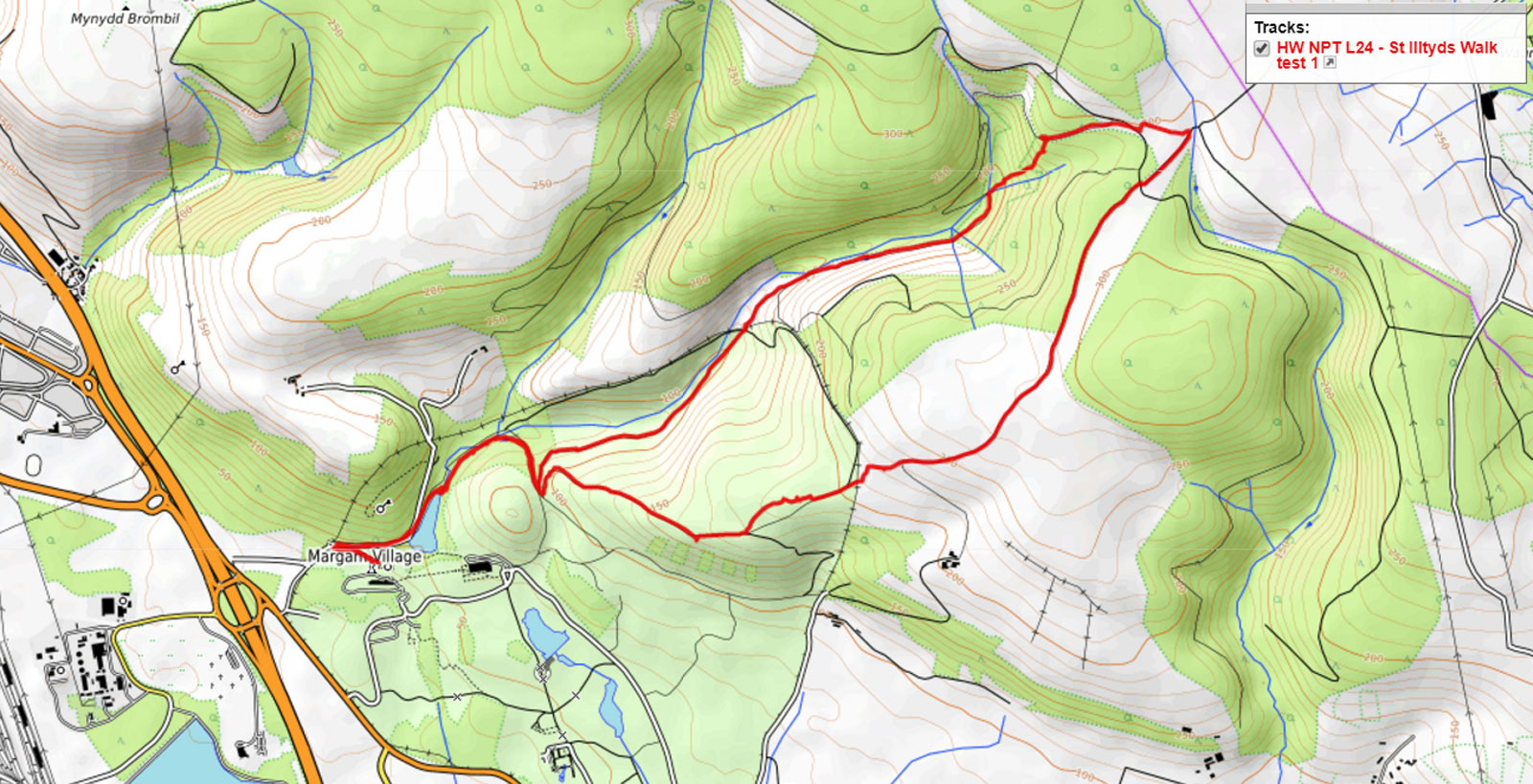
Walk 24 - MARGAM MOUNTAIN to MARGAM ABBEY - walk date 27/7/2017 - CLICK HERE FOR MORE INFO
|
Info to follow | . . |
GARMIN DIED ABOUT HERE - RIP ROUTE INFORMATION FOR A WHILE
STAGE 5 - ST ILLTYD'S WALK - (more about St Illtyd and St Illtyd's Walk - CLICK HERE )
Walk 25 ( St Illtyd 1 ) - MARGAM ABBEY to MARGAM MOUNTAIN - walk date 10/8/2017 - CLICK HERE FOR MORE INFO
| Info to follow | 25. . |
Walk 26 ( St Illtyd 2 ) - MARGAM MOUNTAIN to MAESTEG GOLF CLUB - walk date 23/6/2018
| Starting at the small car park on the top of the hill between Maesteg & Bryn we followed the path across the golf course, soon after joining the St Illtyd's walk (in reverse) we turned left down Cwm Sychbant and made our way across country to the village of Llangynwyd. Climbing out of the village we picked up the St Illtyd's walk near it's juction with the Ogwr Ridgeway. We then followed the walk over Margam Mountain and back to Maesteg golf course. | 26. . |
Walk 27 - (St Illtyd 3 ) - MAESTEG GOLF CLUB to AFAN FOREST - walk date 30/6/2018 - CLICK HERE FOR MORE INFO
| Info to follow | 27. . |
Walk 28 ( St Illtyd 4 ) - AFAN FOREST TO AFAN FOREST VISITOR CENTRE - walk date 7/11/2018 - CLICK HERE FOR WALK BLOG
| Info to follow | 28. . |
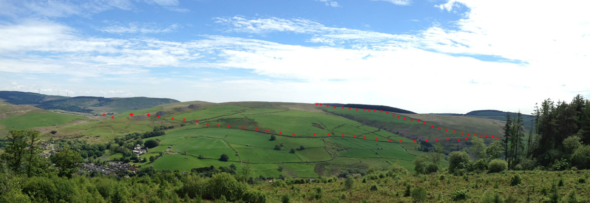
Part of Walk 28 as seen from Mynydd Nant - y - bar on Walk 29
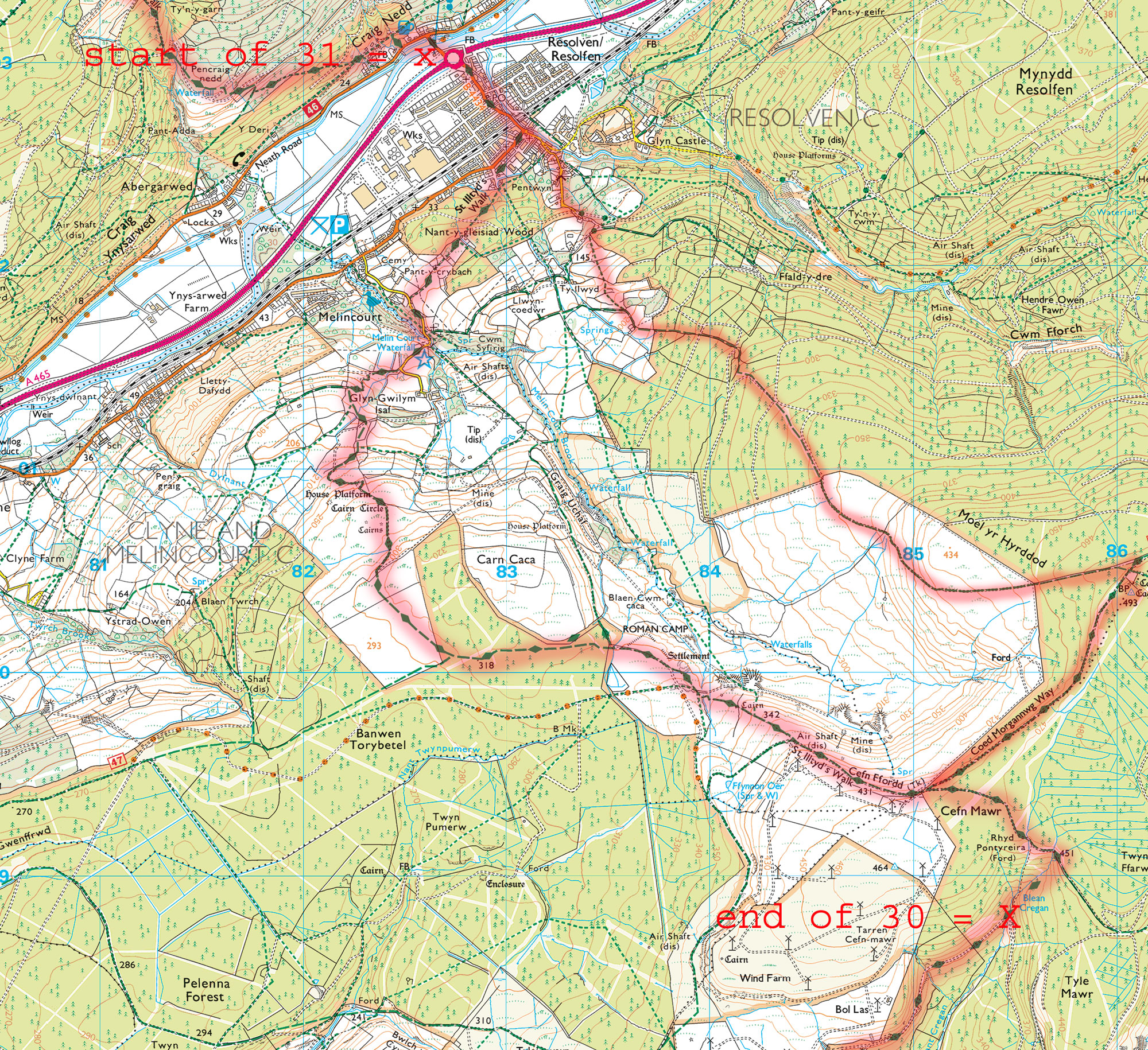
Walk 29 & 30 combined - ( St Illtyd 5 & 6 ) - AFAN FOREST VISITOR CENTRE TO BLAEN CREGAN - walk date 23 May 2019 - CLICK HERE FOR THE WALK BLOG

|
Not signposted for the first 3-4 miles. Map navigation and alternate route selection is essential for these walks. Illustrated left, proposed route in red, actual route I took in blue. | no recorded route available |
Walk 31 - ( St Illtyd 7 ) - BLAEN CREGAN to RESOLVEN - walk date ?? - CLICK HERE FOR MORE INFO
|
Info to follow - I know I did the walk but the info has sunk into the mists of time | 31. . |
Walk 32 - ( St Illtyd 8 ) - RESOLVEN to HIRFYNYDD TOP - CLICK HERE FOR MORE INFO

|
21 October 2024 - |
Walk 33 - ( St Illtyd 9 ) - - walk date ?? - CLICK HERE FOR MORE INFO
Walk 34 - ( St Illtyd 10 ) - - walk date ?? - CLICK HERE FOR MORE INFO
Walk 35 - ( St Illtyd 11 ) - - walk date ?? - CLICK HERE FOR MORE INFO
Walk 36 - ( St Illtyd 12 ) - - walk date ?? - CLICK HERE FOR MORE INFO
| www.visitnpt.co.uk - visit Neath-Port Talbot |
|
Search the website with Google |
Walk ?? - to - walk date ?? - CLICK HERE FOR MORE INFO
| Info to follow | 29. . |